

Earthquake Research
Beneath the ocean, the Earth is constantly in motion. Tectonic plates grind together, magma chambers fill and empty, fluids circulate through hot rock. These processes release energy in earthquakes that tell us stories about our planet. At NOC, we place sophisticated instruments on the seafloor to listen to these signals, transforming vibrations into knowledge about everything from volcanic eruptions to the creation of new ocean crust. This research isn't just about understanding earthquakes. It's about protecting communities, monitoring underwater volcanoes, and unlocking the subsurface potential for achieving net zero.
Earthquakes are a sudden release of strain energy inside the Earth, which results in ground vibrations linked to the propagation of seismic waves. This happens when stress builds up within the Earth and is suddenly released during the rupture of a fault, most commonly at the boundaries between two tectonic plates.
These plate boundaries occur throughout the ocean basins. At mid-ocean ridges, plates pull apart and new oceanic crust forms, creating long mountain chains along the seafloor. At subduction zones, one plate is pushed beneath another, forming deep trenches and producing some of the most powerful earthquakes on Earth. Because tectonic plate boundaries run beneath all the world's oceans, the marine environment becomes a critical laboratory for understanding earthquake processes and their impacts on both the seafloor and coastal communities.
What other types of seismic events occur beneath the ocean?
Beyond traditional earthquakes, the ocean floor experiences a rich variety of seismic signals that reveal different processes happening inside the Earth. In volcanic settings, we detect long-period events that result from magma movement and volcanic tremor that indicates sustained fluid migration. These signals can tell us whether a volcano is filling with new magma or whether seawater is infiltrating the volcanic system, which can make eruptions more explosive.
We also detect short-duration events in gas or fluid-bearing sediments, signals from hydrothermal circulation where hot fluids rise through the seafloor, and seismicity induced by human activities such as resource extraction or carbon storage. Each type of event has its own distinctive signature, and learning to recognise these patterns helps us understand what's happening kilometres beneath the seafloor. It's information that's impossible to gather any other way.
Why is studying marine earthquakes important?
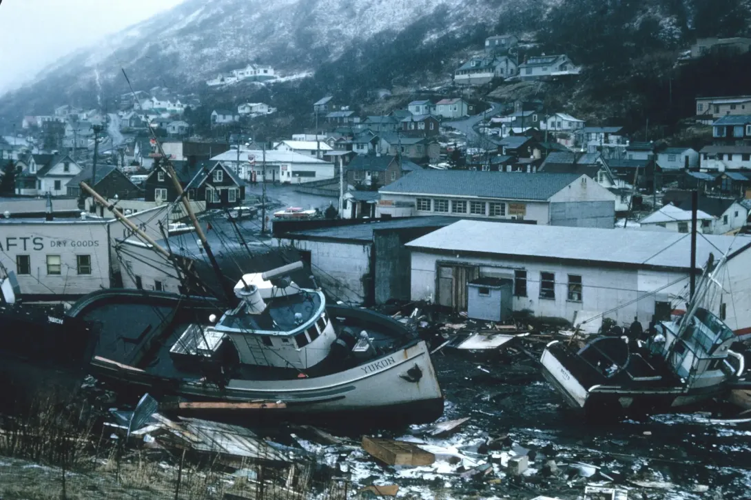
Earthquakes beneath the ocean pose significant hazards to coastal communities worldwide through both direct ground shaking and tsunami generation. When powerful earthquakes occur beneath the sea, they can trigger tsunamis that travel across entire ocean basins, threatening coastlines thousands of kilometres from the source. These waves can arrive with devastating force, and understanding the earthquake processes that generate them is essential for early warning systems that protect millions of people living in coastal areas.
But the importance of earthquake research extends well beyond hazard assessment. Earthquakes can also trigger underwater landslides down steep submarine slopes, which themselves can generate tsunamis whilst damaging fragile seafloor habitats. Understanding where and when these events are likely to occur helps us protect both human communities and marine ecosystems.
What can earthquakes tell us about volcanic hazards?
When we map patterns of seismic events at underwater volcanoes, we're essentially tracking the movement of fluids beneath the surface. Clusters of earthquakes can indicate magma moving upwards to recharge a magma chamber, giving us advance warning of potential eruptions. Perhaps more critically, certain types of seismic signals reveal when seawater is infiltrating deep into the volcanic system. This matters enormously because water can transform an otherwise gentle eruption into an explosive event.
Without monitoring these seismic signals, we lose crucial information about how much magma is available to a volcano and what style of eruption we might expect. This uncertainty makes it far more difficult to protect coastal communities and maritime operations near active volcanic systems. The seismic monitoring we conduct isn't just academic curiosity. It's a vital tool for understanding volcanic behaviour and keeping people safe.
How do earthquakes help us understand ocean chemistry and life?
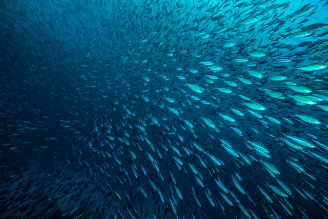
The movement of fluids through the seafloor, particularly the circulation of seawater through hot rock at mid-ocean ridges, profoundly influences ocean chemistry. When we use seismic monitoring to map where and how these fluids move, we're gaining insights into chemical exchanges that affect the ocean's ability to support life. The chemistry of seawater influences everything from which organisms can thrive to how the ocean absorbs carbon dioxide from the atmosphere.
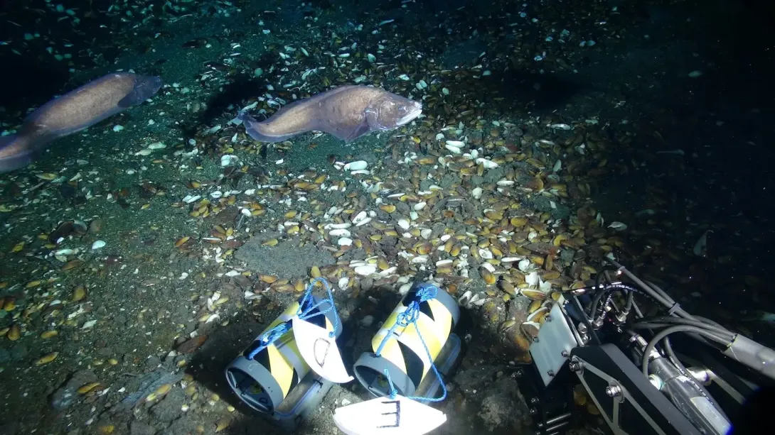
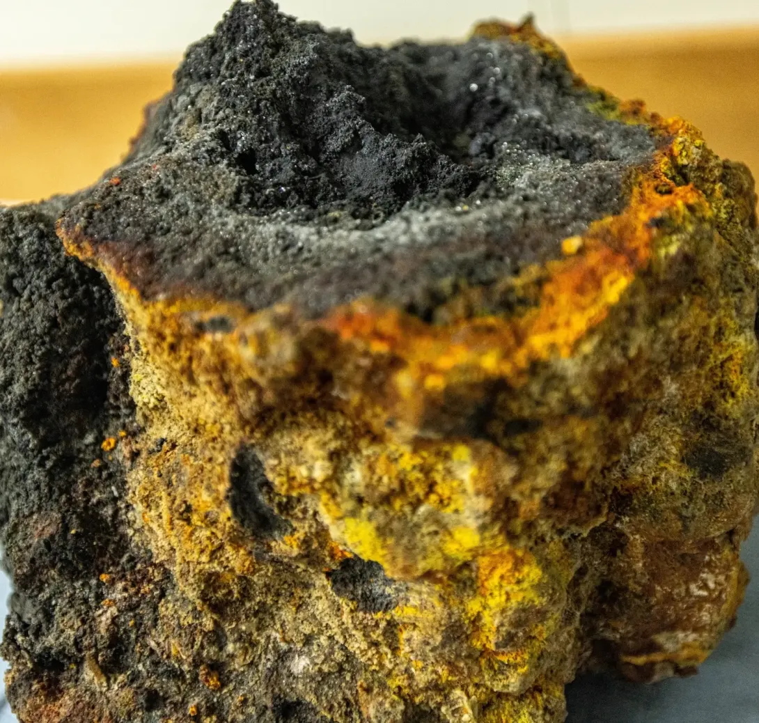
These hydrothermal systems, which we detect and map using seismic methods, support extraordinary chemosynthetic ecosystems that exist in complete darkness, deriving energy from chemical reactions rather than sunlight. Understanding the chemical composition of fluids emerging from these systems also tells us about the Earth's interior and helps explain why different volcanic regions produce different types of eruptions and associated hazards. The interplay between Earth's interior and ocean chemistry shapes both the geological and biological character of our ocean planet.

What can earthquakes reveal about Earth's structure?
Seismic waves travelling through the Earth act as a natural imaging system, revealing the planet's layered structure in ways no other tool can match. When an earthquake occurs, it generates waves that travel through different materials at different speeds, bending and reflecting as they encounter boundaries between layers. By recording these waves at multiple locations and analysing their arrival times and characteristics, we can map the Earth's interior. This technique has revealed that the Earth's core is liquid, has shown us how the crust forms and evolves, and continues to unveil new details about the deep structure beneath ocean basins.
This isn't just about satisfying curiosity about Earth's interior. Understanding how new oceanic crust forms at mid-ocean ridges and how it's recycled at subduction zones helps us comprehend the fundamental processes that shape our planet. These processes control everything from the distribution of mineral resources to the long-term regulation of atmospheric carbon dioxide through the carbon cycle, making earthquake research relevant to understanding Earth as a system.
How does earthquake research support carbon capture and storage?
As we work towards net zero emissions, safely storing carbon dioxide in subsurface formations becomes increasingly important. Seismic monitoring plays a crucial role in ensuring these storage sites work as intended. When carbon dioxide is injected underground, we can use seismic instruments to track how it moves through the rock formations, confirming it remains securely trapped rather than migrating in unexpected ways.
Understanding the mechanics of fault rupture and what controls the release of seismic energy becomes particularly relevant when we're deliberately altering subsurface pressure by injecting fluids or gases. Any industrial activity that changes subsurface conditions can potentially induce earthquakes, and knowing how to monitor and manage this induced seismicity is essential for safe operations. Unlocking the subsurface potential for net zero, whether through carbon storage, geothermal energy, or hydrogen storage, requires safeguarding these operations against hazardous levels of induced seismicity. The research we conduct on natural earthquake systems directly informs how we manage these engineered systems.
What is NOC Doing?
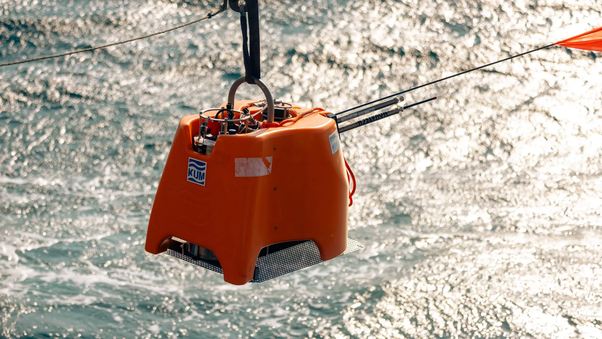
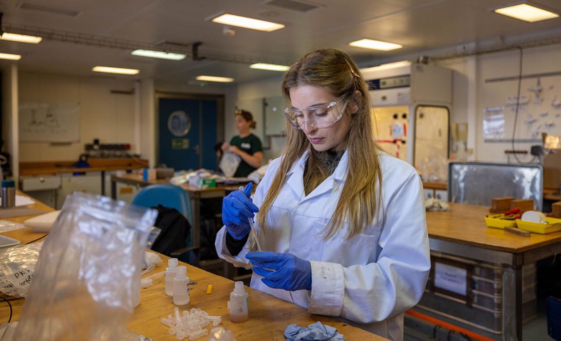
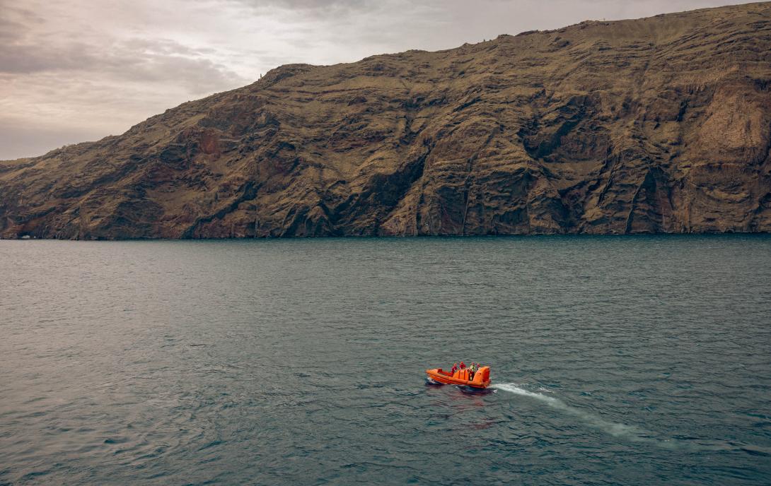
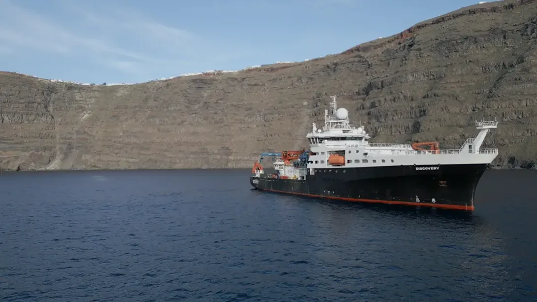
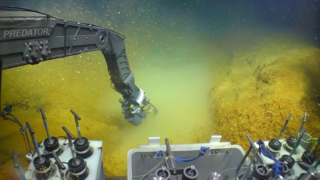
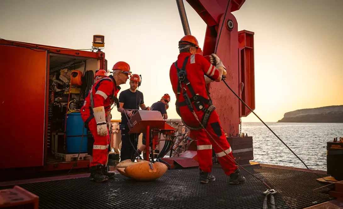
We study earthquakes and other types of seismicity using ocean bottom seismometers, sophisticated instruments that we place directly on the seafloor in our study areas. These devices record seismic signals continuously, capturing everything from tiny vibrations to major earthquakes. After a deployment period that might last weeks or months, we return with a research vessel to recover the instruments and download their data.
The deployment method depends on the type of instrument and the precision required. For many deployments, we use the UK research vessels RRS James Cook or RRS Discovery, lowering the seismometers to the seafloor on cables. But when we need exact placement, perhaps right next to a hydrothermal vent or a specific geological feature, we employ the remotely operated vehicle ISIS. The ROV allows us to position instruments with centimetre-scale precision and navigate complex seafloor terrain that would be difficult to access any other way. Some deployments also include electromagnetic instruments that measure how electrical conductivity varies beneath the seafloor, revealing temperature structure and fluid content.
Once we've recovered the instruments and downloaded their data, the real detective work begins. Modern seismic datasets can contain months of continuous recordings, representing hundreds of thousands or even millions of individual seismic events. Manually identifying and analysing all these events would be impossible, so we increasingly rely on machine learning algorithms that can automatically detect and classify different types of seismicity.
Beyond simply counting events, we use sophisticated modelling techniques to determine precisely where each earthquake occurred, how much energy it released, and what kind of fault movement caused it. By examining the detailed characteristics of seismic waveforms, we can distinguish between different processes. A tectonic earthquake looks quite different from an event caused by fluid movement or volcanic activity. We also use earthquakes as a natural imaging tool, much like a medical ultrasound, building three-dimensional maps of the structure beneath the seafloor that reveal everything from magma chambers to zones of circulating hydrothermal fluids.
Santorini expedition
In March 2025, NOC led an expedition aboard RRS Discovery to collect seismic data from the seafloor surrounding the volcanic island of Santorini. This project brought together seismologists and volcanologists working to understand the pathways through which fluids move within the volcano, pathways that may control whether future eruptions are gentle or explosive. We also collaborated with sedimentologists and geochemists who study the physical and chemical record of past volcanic activity, helping us understand how the system has behaved over longer timescales.
What was the Santorini expedition about?
The project involved international partnerships with researchers in Greece, Canada, the United States, and Germany, each contributing different instruments and expertise to build a comprehensive picture of the volcanic system. As it happened, our instruments were recording when the early 2025 seismic swarm began. Hundreds of small earthquakes made headlines worldwide and raised questions about whether the volcano might be awakening. Our data will help the scientific community better understand what triggered this swarm, whether it represents magma movement or some other process, and what it might mean for future volcanic activity. This real-time capture of a significant seismic sequence demonstrates why continuous monitoring of active volcanic systems matters.
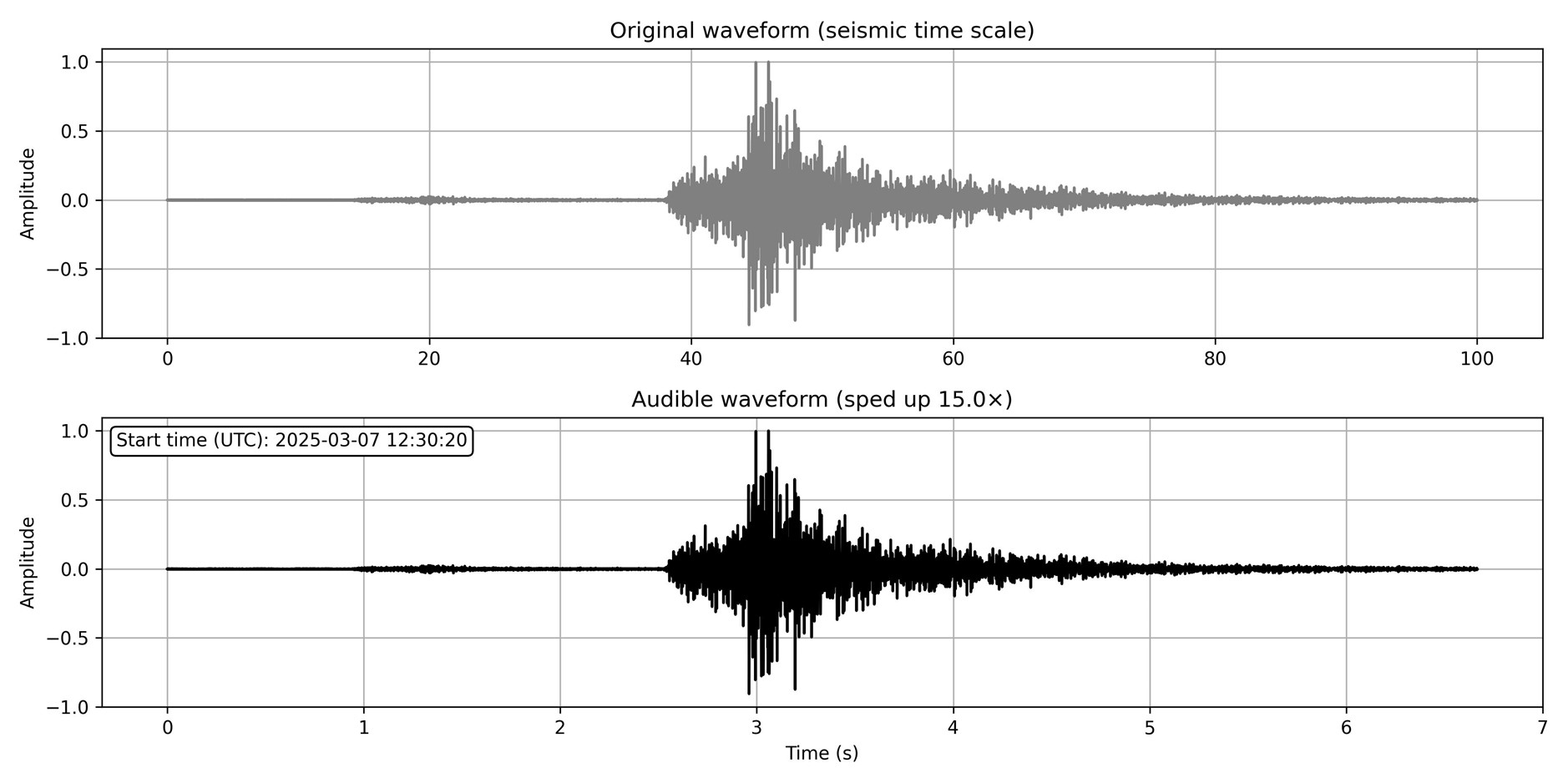
Below is a time series of the signal of a local, tectonic earthquake recorded by an OBX receiver in the Santorini deployment during March 2025. Top: 100-second waveform window of a tectonic event recorded between 12:30:20 and 12:32:00 UTC. Bottom: The same event, time-compressed by a factor of 15 to shift its low-frequency content into the human audible range.
What research is planned at Lucky Strike?
Beginning next year, NOC will participate in a new project at the Lucky Strike hydrothermal field on the Mid-Atlantic Ridge. This site is particularly interesting because it sits directly on the boundary where two tectonic plates are pulling apart and new oceanic crust is forming. We'll conduct two expeditions to deploy and then recover ocean bottom seismometers and electromagnetic instruments that will help us investigate how heat flows from the Earth's interior, how hydrothermal fluids circulate through the newly formed crust, and how this circulation affects the chemical exchange between Earth and ocean.
Mid-ocean ridges are where new seafloor is born, and hydrothermal systems at these ridges play outsized roles in ocean chemistry despite occupying relatively small areas. The fluids emerging from these vents carry dissolved minerals and support unique ecosystems that derive energy from chemistry rather than sunlight. By understanding the seismic and electromagnetic signatures of these systems, we gain insights into fundamental processes that shape both the solid Earth and the ocean that covers it. The Lucky Strike project exemplifies how earthquake monitoring reveals processes operating across the interface between geology, oceanography, and biology.
What is the Rock Physics Laboratory?
Whilst much of our work involves placing instruments on the seafloor, we also conduct complementary research in the laboratory. In NOC's Rock Physics Laboratory, researchers investigate the fundamental processes that govern how earthquakes nucleate, that critical moment when stress overcomes friction and a fault begins to slip. We study how human activities can trigger earthquakes, knowledge that's essential for safely managing subsurface operations from resource extraction to carbon storage.
The laboratory work focuses on understanding how rocks behave under the extreme pressures and temperatures found deep within the Earth. At what point do rocks deform elastically, storing energy that might later be released in an earthquake? When do they fail catastrophically? These laboratory insights help us interpret the earthquakes we record on the seafloor and inform how we assess and manage induced seismicity. The combination of field observations and controlled laboratory experiments provides a more complete understanding than either approach could achieve alone.
What publications has NOC's earthquake research produced?
Our earthquake research has resulted in publications that span fundamental science and practical applications. The textbook "Noisy Oceans: Monitoring Seismic and Acoustic Signals in the Marine Environment" provides comprehensive coverage of how we monitor and interpret the underwater soundscape, including unusual seismic signals that reveal exotic processes.
More recently, we've published research on managing induced seismicity through seismic event rate control, work that has direct implications for safe subsurface operations including carbon storage and geothermal energy production. This Nature publication demonstrates how fundamental research on earthquake mechanics translates into practical tools for risk management. These publications reflect our commitment to research that advances both scientific understanding and societal benefit.
Bayrakci, Gaye; Belal, Mohammad  ORCID: https://orcid.org/0000-0001-5175-3158; Clare, Michael A. ORCID: https://orcid.org/0000-0003-1448-3878.
2023
Noisy Oceans: Monitoring Seismic and Acoustic Signals in the Marine Environment.
American Geophysical Union, 288pp.
(Geophysical Monograph Series).
ORCID: https://orcid.org/0000-0001-5175-3158; Clare, Michael A. ORCID: https://orcid.org/0000-0003-1448-3878.
2023
Noisy Oceans: Monitoring Seismic and Acoustic Signals in the Marine Environment.
American Geophysical Union, 288pp.
(Geophysical Monograph Series).
2023
Book
How has NOC engaged the public about earthquake research?
When we conducted the Santorini expedition in March 2025, the BBC joined us aboard RRS Discovery for a day at sea. Their coverage brought marine geophysics research to a broad audience, showing how scientists actually work to monitor active volcanic systems. The BBC's article about the expedition captures both the technical challenges and the scientific excitement of seafloor seismic monitoring.
We're also planning to present the first results from the Santorini project at the American Geophysical Union conference in December 2025, in a special session focused specifically on Santorini volcano. This conference presentation will mark the first public sharing of what we learned from the seismic swarm captured by our instruments. Beyond these formal channels, we use audio processing to make earthquake recordings audible, creating sensory experiences that help people connect with Earth processes they can't normally perceive. There's something powerful about actually hearing an earthquake, even though it's been artificially sped up. It makes abstract geophysical data suddenly vivid and real.
How does earthquake research connect to broader NOC missions?
Earthquake research at NOC exemplifies how fundamental Earth science connects to practical societal needs. When we place seismometers on the seafloor near an active volcano, we're simultaneously advancing our understanding of how magmatic systems work whilst providing information that helps protect coastal communities from volcanic hazards. When we monitor induced seismicity at carbon storage sites, we're enabling the safe deployment of technologies essential for achieving net zero emissions.
This research also drives technological innovation. The instruments we develop for harsh seafloor environments push the boundaries of sensor technology, and the data analysis methods we create to find patterns in vast seismic datasets have applications beyond earthquake research. Our international collaborations bring together diverse expertise, from instrument engineers to volcanologists to machine learning specialists, creating research capabilities that transcend traditional disciplinary boundaries. Through public engagement efforts that make invisible Earth processes tangible, we help people understand why studying what happens beneath the seafloor matters for everyone living on the ocean planet.
Interested in learning more about our research on earthquakes?
Connect with our research teams to discover how we help protect communities, monitoring underwater volcanoes.