

Why does sea level matter?
Sea level has long fascinated coastal cultures, shaping navigation, dictating fishing practices, and influencing daily life. In modern science, it plays an even more critical role. Sitting at the boundary between the ocean and the atmosphere, sea level is a key climate indicator, essential to both oceanography and climatology.
Sea level is also crucial in geodesy, the science of measuring the Earth. Tide gauges measure both land and sea height changes, and historically helped define the datum above which all heights were measured. For example, in the UK, height measurements are based on readings taken in Newlyn, Cornwall between 1915 and 1921.
Why is understanding sea level change important?
Accurate predictions of sea level and tides are vital for public safety and planning. They support safe navigation, coastal access, and storm surge forecasting, all of which protect lives and livelihoods in coastal communities across the world.
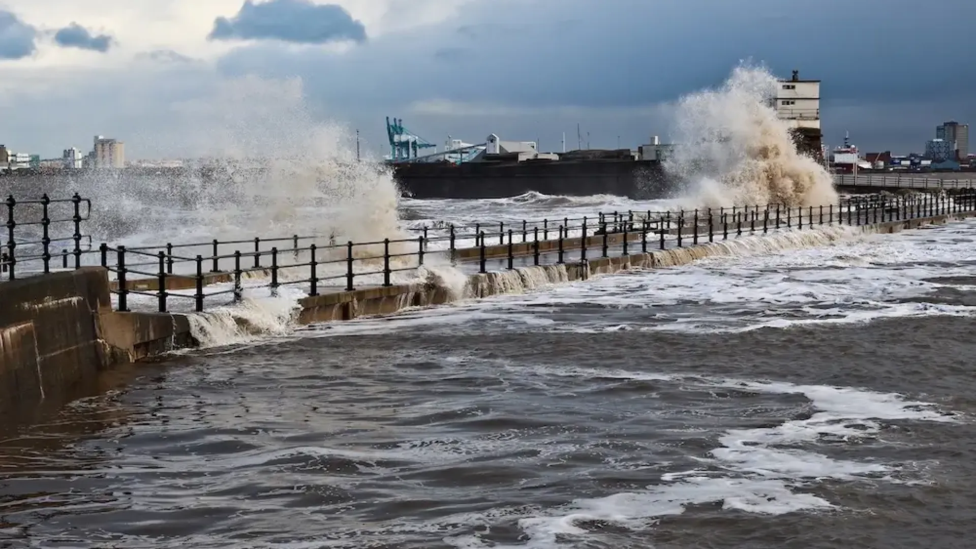
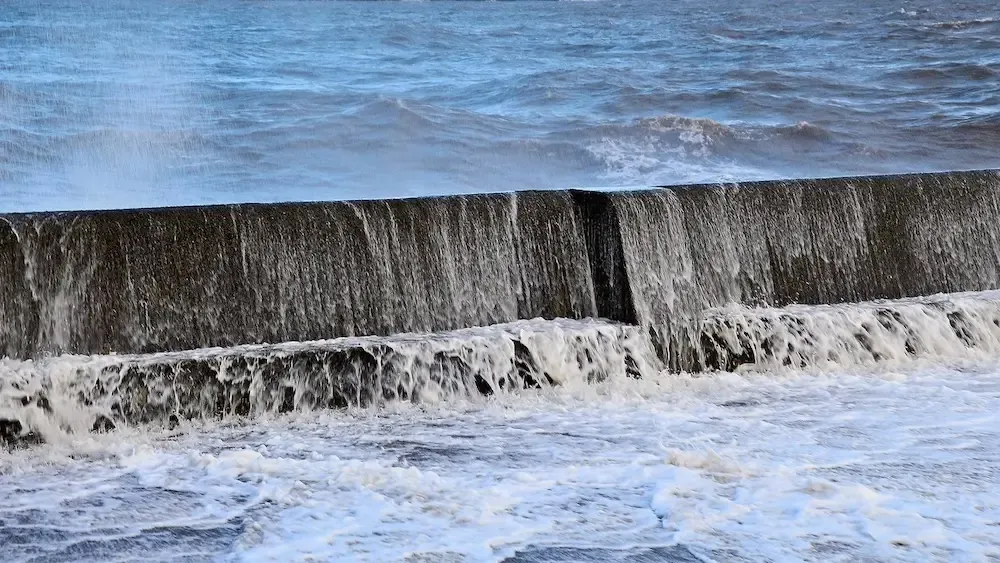
As extreme sea level events become more common with climate change, better knowledge helps planners design and time defences to protect infrastructure. Long-term forecasts help policymakers decide when to upgrade, reinforce, or even withdraw from certain coastal defences as the risk of flooding increases.
Facts and Figures
Global Sea Level Rise since 1993
Ocean mass increase
Greenland ice mass change


Podcasts


How is NOC researching sea level change?
The National Oceanography Centre and its predecessors have been at the forefront of sea level science for over a century. In the early 20th century, NOC scientists Joseph Proudman and Arthur Doodson were pioneers of tidal science. In 1933, Proudman began gathering global mean sea level records from tide gauges, creating the Permanent Service for Mean Sea Level (PSMSL), a global dataset still central to our understanding of sea level change.
NOC maintains the UK’s national tide gauge network, providing high quality sea-level information to monitor long term sea level change at coastal locations across the UK, with the distribution and quality control of the data managed by the British Oceanographic Data Centre (BODC). We also maintain the UK South Atlantic tide gauge network, stretching from Gibraltar to remote islands and the Antarctic Peninsula. This forms a major part of the UK’s contribution to the Global Sea Level Observing System (GLOSS). Many of these sites are in harsh, remote locations. Our engineers design robust, easy-to-maintain systems that can be operated by local non-experts.
NOC’s work on sea level, both mean and extreme, underpins global efforts to understand a changing climate, prepare for future risks, and protect coastal communities.
Publications
One of the outputs of our science is publications. Publications show the impact and relevance of our science and technology.
Qu, Ying; Jevrejeva, Svetlana  ORCID: https://orcid.org/0000-0001-9490-4665; Jackson, Luke P.; Moore, John C..
2019
Coastal Sea level rise around the China Seas.
Global and Planetary Change, 172.
454-463.
10.1016/j.gloplacha.2018.11.005
ORCID: https://orcid.org/0000-0001-9490-4665; Jackson, Luke P.; Moore, John C..
2019
Coastal Sea level rise around the China Seas.
Global and Planetary Change, 172.
454-463.
10.1016/j.gloplacha.2018.11.005
2019
Article
Bernier, Natacha B.; Hemer, Mark; Mori, Nobuhito; Appendini, Christian M.; Breivik, Oyvind; de Camargo, Ricardo; Casas-Prat, Mercè; Duong, Trang M.; Haigh, Ivan D.; Howard, Tom; Hernaman, Vanessa; Huizy, Oleksandr; Irish, Jennifer L.; Kirezci, Ebru; Kohno, Nadao; Lee, Jun-Whan; McInnes, Kathleen L.; Meyer, Elke M.I.; Marcos, Marta; Marsooli, Reza; Martin Oliva, Ariadna; Menendez, Melisa; Moghimi, Saeed; Muis, Sanne; Polton, Jeff A. ORCID: https://orcid.org/0000-0003-0131-5250; Pringle, William J.; Ranasinghe, Roshanka; Saillour, Thomas; Smith, Grant; Tadesse, Michael Getachew; Swail, Val; Tomoya, Shimura; Voukouvalas, Evangelos; Wahl, Thomas; Wang, Pengcheng; Weisse, Ralf; Westerink, Joannes J.; Young, Ian; Zhang, Y. Joseph.
2024
Storm surges and extreme sea levels: Review, establishment of model intercomparison and coordination of surge climate projection efforts (SurgeMIP).
Weather and Climate Extremes, 45, 100689.
10.1016/j.wace.2024.100689
2024
Article
Holgate, Simon J.; Matthews, Andrew ORCID: https://orcid.org/0000-0001-5210-2453; Woodworth, Philip L.; Rickards, Lesley J.; Tamisiea, Mark E.; Bradshaw, Elizabeth; Foden, Peter R.; Gordon, Kathleen M; Jevrejeva, Svetlana ORCID: https://orcid.org/0000-0001-9490-4665; Pugh, Jeff ORCID: https://orcid.org/0000-0002-7173-1674.
2013
New Data Systems and Products at the Permanent Service for Mean Sea Level.
Journal of Coastal Research, 29 (3).
493-504.
10.2112/JCOASTRES-D-12-00175.1
2013
Article

Tide and Time Exhibition
Historic tide prediction machines that produced forecasts before the age of computers.