

Milestone Anniversary of Long Term Ocean Observing
The DY174 expedition saw the servicing of the RAPID-AMOC 26°N array, marking the 20th anniversary of intensive study of the Atlantic Meridional Overturning Circulation (AMOC).
It is one of the longest running, continual sustained deep-ocean observation arrays in the world. Observations, using cutting-edge technology and instruments, secured across a section of ocean 5000m deep, have revolutionised the understanding of the AMOC’s variability and documented its impacts on our long term climate and seasonal European weather.
Expedition Diary
| Ship | Duration | Departed | Returned | General Location | Chief Scientist |
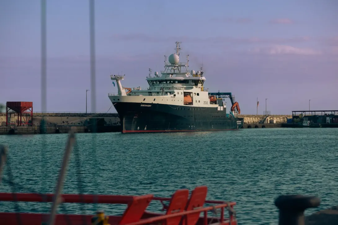
| RRS Discovery | 28/3/24 - 3/4/24 (6 days) | Tenerife, Spain | Tenerife, Spain | North East Atlantic Ocean | Dr Ben Moat |
The purpose of RRS Discovery research expedition DY174 was to refurbish the Eastern Boundary of the RAPID 26°N array of moorings that span the Atlantic from the Bahamas to the Canary Islands. The expedition started in Santa Cruz de Tenerife on Thursday 28th March 2024 and ended on Wednesday 3rd April 2024 at Santa Cruz de Tenerife.
The moorings are part of a purposeful Atlantic wide array that observes the Atlantic Meridional Overturning Circulation (AMOC) and the associated heat and freshwater transports. The RAPID-MOCHA-WBTS array is a joint UK- US programme.
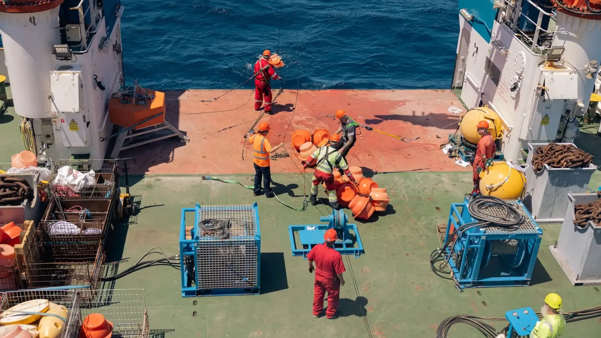
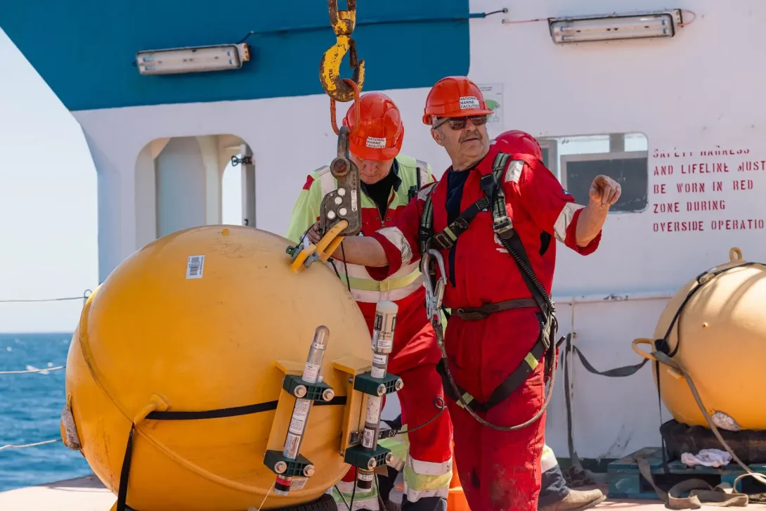
During DY174 moorings were serviced at sites: EBH3, EBH3L, EBH2, EBH1, EBH1L. A new mooring was deployed at EBH3B as a backup for EBH3. Sites with suffix ‘L’ denote landers fitted with bottom pressure recorders.
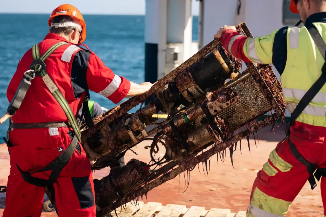
Moorings were equipped with instruments to measure temperature, conductivity and pressure, and a number of moorings were also equipped with current meters and/or oxygen sensors. ‘Lab on a chip’ sensors deployed 2 years ago as part of the EPOC project were recovered.
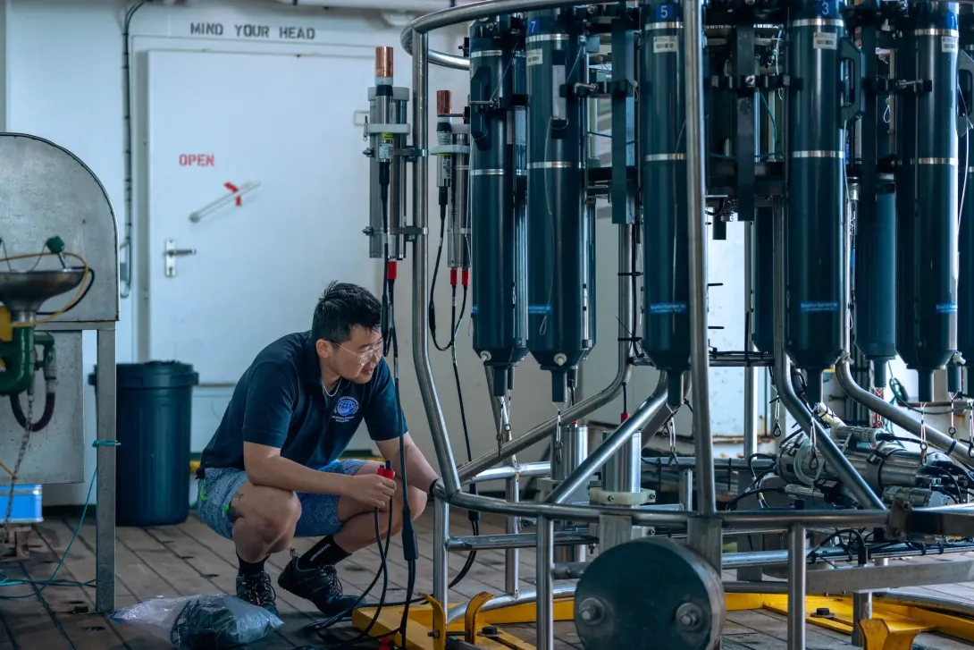
CTD stations were conducted throughout the cruise for purposes of providing pre- and post-deployment calibrations for mooring instrumentation.
Shipboard underway measurements were systematically logged, processed and calibrated, including: surface meteorology, 5m depth sea temperatures and salinities, water depth, and navigation. Water velocity profiles from 15 m to approximately 800m depth were obtained using two vessel mounted Acoustic Doppler Current Profilers (one 75 kHz and one 150 kHz).
What Equipment Was Deployed?
To improve understanding of the meridional transport of carbon by the ocean additional instruments were recovered from moorings to measure Oxygen, pH, phosphate, Nitrate, total Alkalinity and pCO2 sensors.
Learn MoreTo calibrate the moored instruments a number of CTD profiles were made measuring temperature, salinity and oxygen. Water samples were taken and analysed for salinity and oxygen. Some samples will later be analysed for dissolved inorganic carbon, total alkalinity, inorganic nutrients and organic nitrogen.
Two Argo floats were deployed on this expedition to contribute to the larger ARGO program.
Learn More20 Years of RAPID: The Key Stats
Expeditions
Days at sea
Technicians
Scientists
Students
Moorings deployed
Wire used
Around the globe travelled
Research vessels
Nationalities
Where Did DY174 Take Place?
Departing from Tenerife, RRS Discovery headed into the Atlantic to service part of the array, which is situated along roughly 26.5° north latitude, from the Bahamas/Florida region to the Canary Islands off northwest Africa.
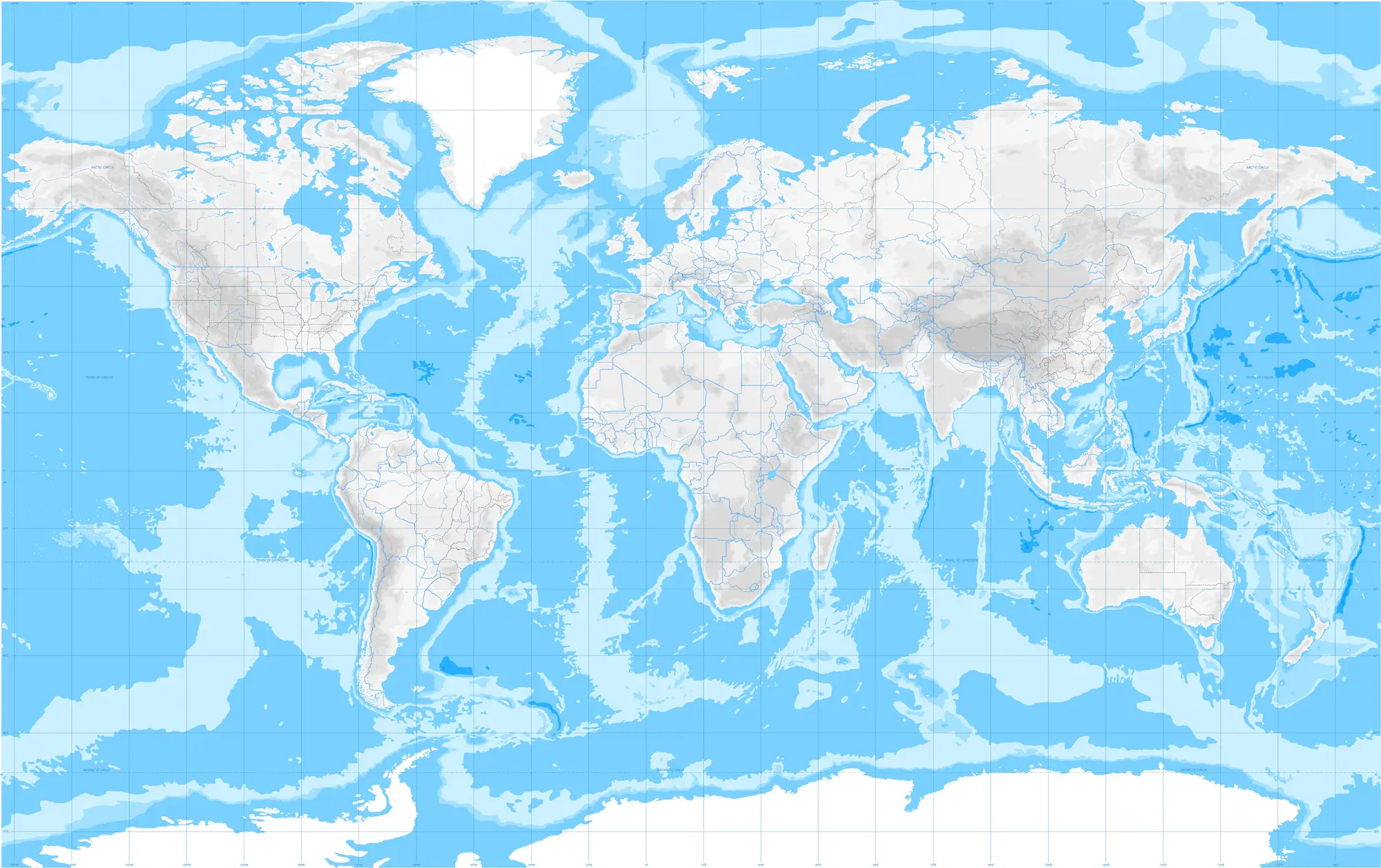
The RAPID-AMOC 26°N Array is a long-running ocean observation system that measures the strength and variability of the Atlantic Meridional Overturning Circulation (AMOC) at about 26.5° north latitude across the Atlantic Ocean. It’s one of the world’s most important climate-monitoring arrays.
The RAPID-AMOC 26°N Array is a long-running ocean observation system that measures the strength and variability of the Atlantic Meridional Overturning Circulation (AMOC) at about 26.5° north latitude across the Atlantic Ocean. It’s one of the world’s most important climate-monitoring arrays.
Expedition Gallery
Along with highly-skilled engineers and scientists, NOC's photographer and videographer was onboard to capture every stage of the significant expedition in the history of the RAPID array. A selection of the photos captured can be seen below.


Learn More About the AMOC
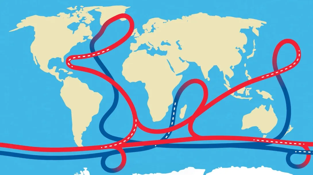
The Atlantic Meridional Overturning Circulation, or AMOC, is a key climate system and is vital in regulating the temperature of the planet. However, in recent years there have been many studies suggesting that its potential slowdown, or even collapse, could have a catastrophic effect on our climate and could lead to more extreme weather. In our animation, we give you a lowdown on what the AMOC is, how it works, what could happen if it does slow down and what NOC is doing to research it.

Dive Deeper: Access the Cruise Report
Via the British Oceanographic Data Centre (BODC), a full cruise report for expeditions are available. This includes information on locations, objectives as well as the data collected.