

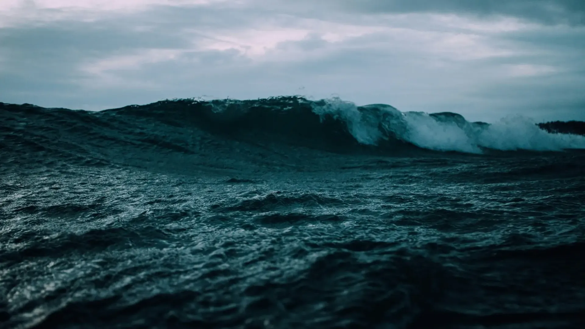
What is a Tsunami?
A tsunami is one or a series of ocean waves caused by a large, sudden displacement of the entire water column. Tsunamis can be triggered by earthquakes, volcanic eruptions, underwater landslides, and even meteorite impacts. However, even high pressure atmospheric waves can create (small) meteotsunamis, which arise through atmospheric pressure/wind disturbances transferring energy into the water, often strongly amplified when atmospheric disturbance speed matches the long-wave speed through resonance.
Of these triggers, most tsunamis (over 80%) are caused by large underwater earthquakes at tectonic plate boundaries. Earthquakes transmit huge amounts of energy and often fracture the seafloor; the movement of the seafloor and energy involved displaces massive volumes of seawater, creating waves that can travel across entire ocean basins at remarkable speeds.
How is a Tsunami Different to Ordinary Ocean Waves?
Ordinary ocean waves we commonly witness at the beach are generated by wind blowing across and agitating the sea surface. These waves typically have wavelengths of about 100 metres and heights of around 2 metres. They affect only the top layer of the ocean and lose energy relatively quickly, especially as they interact with the near- and foreshore.
Tsunamis operate on an entirely different scale. As mentioned, Tsunamis involve motion throughout the water column and operate on a vastly larger spatial scale than ordinary wind waves. A tsunami in the deep ocean can have a wavelength stretching up to 200 kilometres from crest to crest. In deep water, tsunami wave height may be less than a metre, making them almost undetectable to ships at sea. This gives them enormous energy reserves and allows them to travel vast distances without significant energy loss. Historically, tsunamis would only be detectable upon reaching the coast or entering harbours and ports; hence their name from Japanese, where "tsu" means harbour and "nami" means wave, translating literally as "harbour wave."
The tsunami speed also differs dramatically from sea surface waves. While wind waves travel at roughly 16 to 80 kph, tsunamis in the deep ocean can exceed 800 kph. Since tsunamis travel through the entire water column their speed is principally determined by ocean depth; the deeper the water, the faster the tsunami travels. Thus, they are capable of transiting entire ocean basins in hours. It also means that the width and depth of the shallower, surrounding continental shelf can slow a tsunami and dissipate its energy.
Why are Tsunamis Sometimes Mistaken for Tidal Waves?
The term "tidal wave" was once commonly used to describe tsunamis because of how they appear when reaching shore; sometimes mistaken for tidal bores. A tsunami often looks like an extraordinarily rapid rise in sea level, similar to an extremely high and fast-moving tide. This visual similarity led to the popular but technically incorrect term.
Scientists discourage using "tidal wave" because tsunamis have nothing to do with tides. Tides are caused by the gravitational pull of the Moon and Sun on water bodies, following predictable patterns. Tsunamis, by contrast, result from sudden ocean displacement caused by seismic activity, volcanic eruptions, or landslides. Confusing the two could lead to dangerous misunderstandings about their nature and predictability.
Do Tsunamis Occur in Particular Seasons?
No, tsunamis don't follow seasonal patterns. There is no "tsunami season" because the primary causes, such as earthquakes and volcanic eruptions, aren't influenced by weather or time of year. A tsunami can strike any coastline at any time, day or night, summer or winter.
How Do Undersea Earthquakes Generate Tsunamis?
Undersea earthquakes are responsible for approximately 80% of all tsunamis. The mechanism begins deep within Earth's crust, where massive tectonic plates meet at subduction zones. At these boundaries, one plate slowly slides beneath another, building enormous stress over decades or centuries.
When this accumulated stress finally releases, the ocean floor can suddenly shift upward or downward by several metres. This vertical displacement pushes the entire water column above it, creating the initial tsunami wave. An earthquake must generally exceed magnitude 7.0 and occur at a shallow depth (less than 100 kilometres below the surface) to generate a significant tsunami. Earthquakes deeper than this are unlikely to displace the ocean floor sufficiently.
The most destructive tsunamis typically result from "megathrust" earthquakes at subduction zones. The 2004 Indian Ocean tsunami originated from a magnitude 9.1 earthquake that ruptured a fault line stretching roughly 1,300 kilometres, about the length of California. This massive displacement created waves that affected coastlines across the entire Indian Ocean basin.
How Do Volcanic Eruptions and Collapses Create Tsunamis?
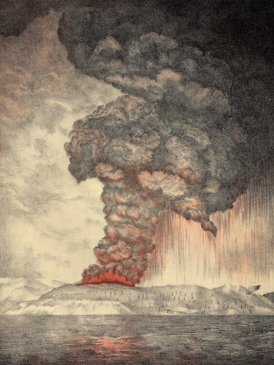
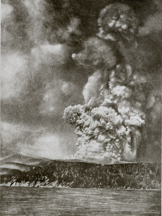
Volcanic activity can generate tsunamis through several mechanisms. Explosive eruptions can directly displace water, while volcanic flank collapses, where part of a volcanic island slides into the sea, can trigger enormous waves.
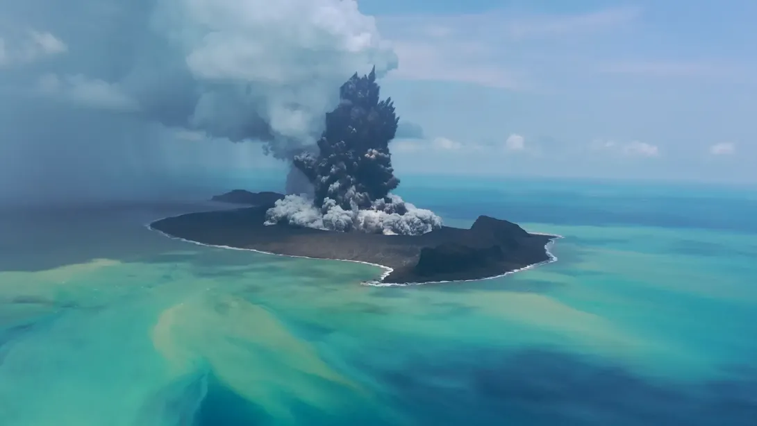
One of history's most devastating volcanic tsunamis occurred in 1883 when Krakatau (often referred to as 'Krakatoa' in English) in Indonesia exploded. The eruption and subsequent collapse created waves estimated at over 30 metres high, killing tens of thousands of people. After the 1883 event at Krakatau, a new volcanic island grew, called Anak Krakatau. Its explosive collapse in 2018 created an eruption-triggered flank collapse and landslide that resulted in the loss of more than 400 people. More recently, the 2022 eruption of Hunga Volcano in the South Pacific generated a tsunami that caused damage across multiple Pacific nations, as discovered in a recent study.
Scientists study volcanic islands worldwide for potential explosive eruptions and collapse risks. The concept of a "mega tsunami," a hypothetical wave of exceptional size caused by massive volcanic collapse, remains a subject of ongoing research, though such events are extremely rare.
How Do Landslides Trigger Tsunamis?
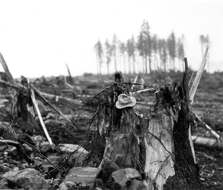
Landslides can generate tsunamis when large volumes of rock, ice, or sediment suddenly enter a body of water. These events can occur above water (subaerial) or beneath the surface (submarine). Either way, the rapid displacement of water by the landslide creates waves that can be locally devastating and even pan-oceanic.
The most extreme recorded example occurred in Lituya Bay, Alaska, in 1958. A massive rockslide triggered by an earthquake sent material crashing into the confined fjord bay, creating a wave that reached an incredible 524 metres up the opposite slope, the tallest wave ever documented. While this was a highly localised event, it demonstrates the immense power landslides can unleash.
Earthquake-triggered submarine landslides can complicate tsunami warnings because the landslide may generate waves independently of the earthquake itself. This dual mechanism can create larger or more complex wave patterns than expected from the earthquake alone.
Where in the World Do Tsunamis Occur?
Tsunamis occur most frequently in the Pacific Ocean, which accounts for the majority of recorded events. The Indian Ocean, Caribbean Sea, Mediterranean Sea, and even the Atlantic Ocean have all experienced tsunamis, though less frequently. Any coastline near active fault zones, volcanic regions, or areas prone to submarine landslides faces potential tsunami risk.
The highest-risk zones correspond to major subduction zones where oceanic plates dive beneath continental plates. These include the coasts surrounding the Pacific, the eastern Indian Ocean along Indonesia and the Andaman Islands, the Caribbean, and parts of the Mediterranean.
The map below shows some of the locations where major tsunamis have occurred.
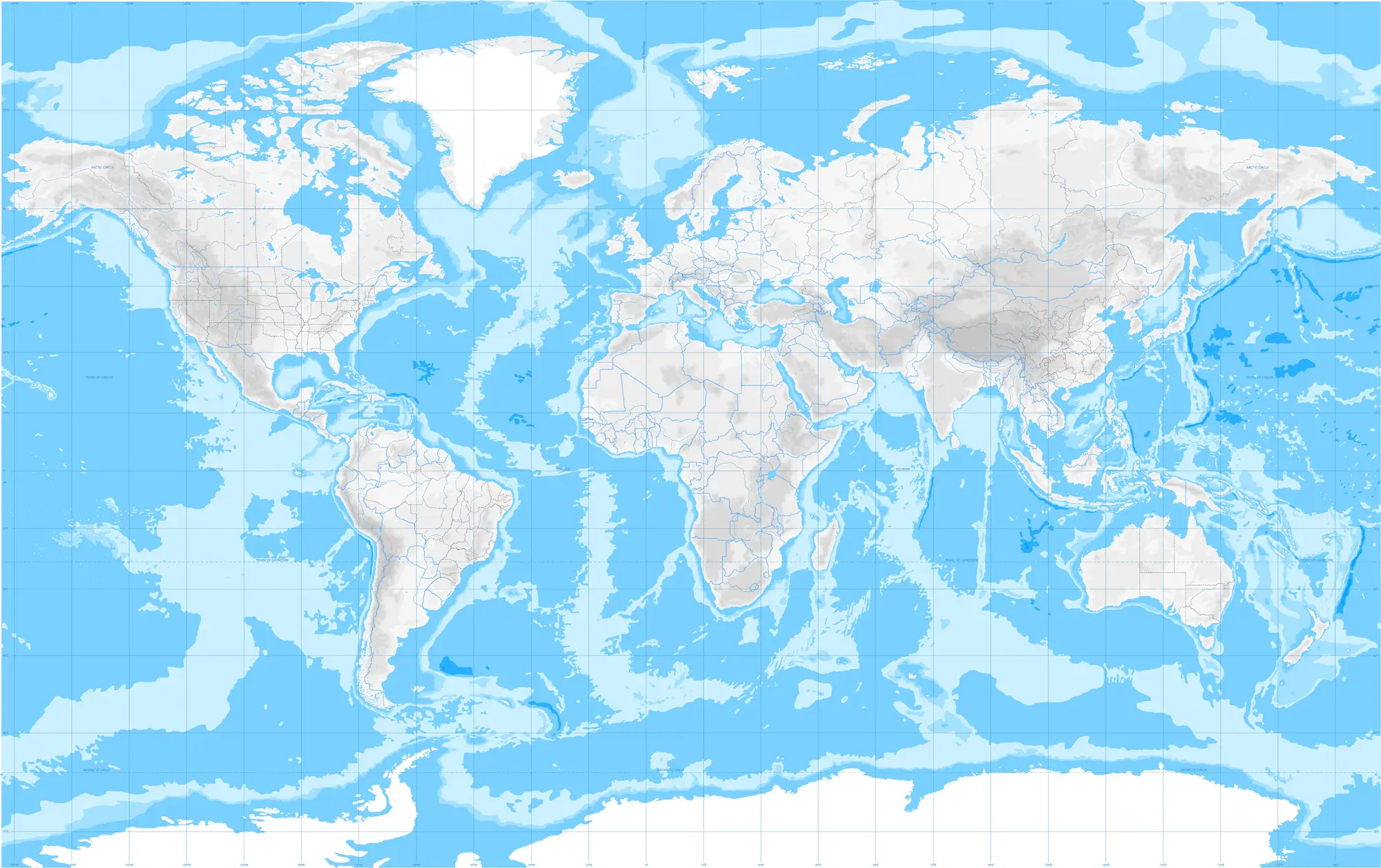
Japan has the longest documented history of tsunamis, with records stretching back over 1,300 years. The country's position along multiple subduction zones makes it particularly vulnerable. Japan has developed some of the world's most sophisticated tsunami warning and mitigation systems in response to this ongoing threat.
Indonesia, sitting atop the volatile meeting point of several tectonic plates, experiences frequent tsunamis.
Chile, with its lengthy coastline along the Peru-Chile Trench, has suffered some of history's most powerful earthquakes and resulting tsunamis.
Hawaii, despite its mid-Pacific location, has been struck by tsunamis generated around the entire Pacific Rim.
The United States also faces tsunami risks along its Pacific Northwest coast (the Cascadia Subduction Zone), Alaska, and Caribbean territories.
Japan has the longest documented history of tsunamis, with records stretching back over 1,300 years. The country's position along multiple subduction zones makes it particularly vulnerable. Japan has developed some of the world's most sophisticated tsunami warning and mitigation systems in response to this ongoing threat.
Indonesia, sitting atop the volatile meeting point of several tectonic plates, experiences frequent tsunamis.
Chile, with its lengthy coastline along the Peru-Chile Trench, has suffered some of history's most powerful earthquakes and resulting tsunamis.
Hawaii, despite its mid-Pacific location, has been struck by tsunamis generated around the entire Pacific Rim.
The United States also faces tsunami risks along its Pacific Northwest coast (the Cascadia Subduction Zone), Alaska, and Caribbean territories.
Why is the Pacific Ocean Especially Prone to Tsunamis?
The Pacific Ocean's exceptional tsunami risk stems from its geological boundaries. The Pacific Ring of Fire, a horseshoe-shaped zone encircling the Pacific basin, contains roughly 75% of the world's active volcanoes and generates about 81% of Earth's largest earthquakes. This ring marks where the Pacific Plate meets and subducts beneath surrounding continental plates.
These subduction zones create ideal conditions for tsunami-generating earthquakes. The trenches along Chile, Japan, Tonga, and Alaska have all produced catastrophic tsunamis throughout history. Approximately 80% of all tsunamis occur within the Pacific Ring of Fire.
Can Tsunamis Occur in Other Oceans and Inland Waters?
Yes, tsunamis can occur in any ocean and even in large lakes. The 2004 Boxing Day tsunami demonstrated that the Indian Ocean, despite having fewer recorded tsunamis than the Pacific, can experience devastating waves. The Mediterranean also has a documented history of tsunamis dating back to ancient times, including events that may have contributed to the decline of ancient civilisations.
Lakes can also experience tsunami-like waves. A meteotsunami struck Ludington, Michigan in 2018, damaging homes and boat docks along Lake Michigan. These meteotsunamis are caused by atmospheric pressure acting on the water body rather than seismic activity.
What are Some Recent Major Tsunamis?
Tsunamis occur more frequently than many people realise. Roughly two tsunamis cause damage near their source each year, and tsunamis that affect distant shores occur about twice per decade. Most are relatively small and don't make international headlines.
Recent significant events include the 2022 tsunami triggered by the Hunga volcanic eruption and various earthquake-generated tsunamis in the western Pacific. On 29 July 2025, a magnitude 8.8 earthquake off the Kamchatka Peninsula generated a Pacific-wide tsunami. In August 2025, a landslide in Tracy Arm fjord, Alaska, generated a megatsunami with a maximum run-up of 481 metres.


How Fast Do Tsunamis Travel Across the Ocean?
Tsunami wave speed depends directly on ocean depth. In the deep ocean where depths average around 4,000 metres, tsunamis can travel at approximately 700 to 800 kilometres per hour, comparable to the speed of a commercial jet aircraft. NOAA provides a simple formula: tsunami speed equals the square root of the water depth multiplied by the acceleration of gravity.
At these speeds, a tsunami can cross the entire Pacific Ocean in less than a day. A tsunami generated in the Aleutian Islands may reach Hawaii in less than four and a half hours. As waves approach shallower coastal waters, they slow dramatically, eventually reaching about 30 to 50 kilometres per hour near shore, still faster than a person can run.
Why Do Tsunami Waves Grow Taller Near the Coast?
This phenomenon, called wave shoaling, explains why tsunamis transform from nearly invisible deep-water waves into towering walls of water at the coast. In deep water, a tsunami might be less than a metre high with a wavelength of hundreds of kilometres. Ships at sea often don't notice tsunamis passing beneath them.
As the wave enters shallower water and slows, its wavelength diminishes to less than 20 kilometres and its amplitude grows enormously. The energy compresses into a smaller volume, forcing the wave height to increase dramatically. A wave that was barely detectable in deep water can grow to 10, 20, or even 30 metres or more at the coastline, depending on local underwater topography.
Do Tsunamis Happen Suddenly Or In Stages?
Tsunamis arrive as a series of waves, often called a "wave train," rather than a single wave. Tsunamis consist of a series of waves with periods ranging from minutes to hours as the result of a complex triggering process or how the wave(s) interact with obstacles along their journey. The time between successive waves can range from 5 to 90 minutes. This creates a particularly dangerous situation because people may believe the threat has passed after the first wave, only to be caught by subsequent, potentially larger waves.
The National Weather Service warns that the first wave is often not the largest. In many tsunamis, the second, third, or even later waves prove most destructive. The wave train can continue for hours, with flooding and dangerous currents persisting long after the initial arrival. Recent studies discovered that this was the case in the 2022 Hunga volcanic eruption.
How Far Do Tsunamis Travel?
Tsunamis can travel across entire ocean basins without losing significant energy. The 2004 Indian Ocean tsunami was recorded on tide gauges in the Atlantic and Pacific Oceans, truly a global event. The 2011 Japan tsunami caused damage and one death as far away as California, over 8,000 kilometres from the source.
The enormous wavelength of tsunamis allows them to maintain their energy over vast distances. Unlike wind waves that dissipate relatively quickly, tsunamis behave more like the ripples from a stone dropped in still water, spreading outward in all directions until they encounter a shoreline.
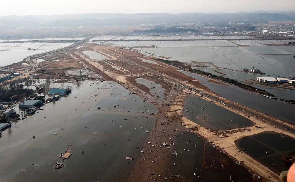
Image Source: U.S. Air Force/Staff Sgt. Samuel Morse, Wikimedia Commons. Public Domain.

How Long Does a Tsunami Last?
Individual waves may take 5 to 60 minutes to flood, recede, and be followed by the next wave. The entire event, from first wave to final dangerous currents, can extend over 6 to 12 hours or more in some cases.
This extended duration makes tsunamis particularly dangerous for rescuers and returning residents. Officials typically wait many hours after the initial impact before allowing people to return to affected areas, ensuring all waves have passed and any residual currents have subsided to safe levels.
What Impact Does a Tsunami Have When it Reaches Land?
Just 15 centimetres of fast-moving water can knock an adult off their feet.
60 centimetres of fast-moving water can carry away cars.
Tsunamis arriving at habitable coastlines can exceed 10 metres in height.
In extreme cases, an arriving tsunami has reached over 30 metres.
How Do Tsunamis Flood and Reshape Coastlines?
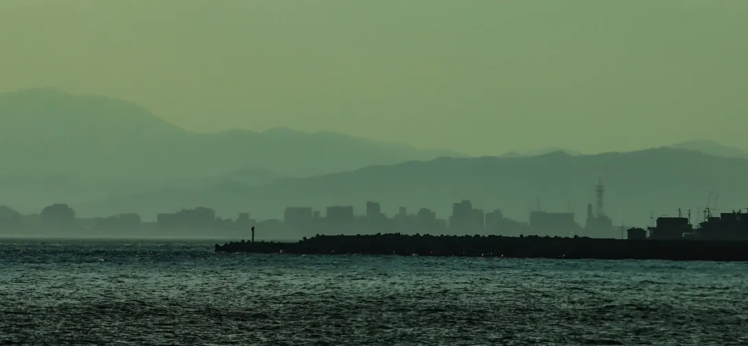
Coastal flooding from tsunamis extends far beyond the initial wave impact. The water continues to push inland for several minutes, carried by the enormous volume and energy of the wave. Low-lying coastal areas can see inundation extending kilometres from the shore, depending on topography.
Tsunamis reshape coastlines through both erosion and deposition. The powerful waves strip away beaches, dunes, and vegetation, and end up carrying vast amounts of debris and sediment before they recede. During the 2011 Japan event, the local coastline subsided half a metre, permanently changing the relationship between land and sea.
What Damage Do Tsunamis Cause to Buildings and Infrastructure?
Tsunami damage comes from multiple forces: the initial impact of the wave, the sustained current during flooding, the impact of debris carried by the water, and the powerful return flow as water returns to the sea. Buildings face lateral water pressure, uplift from buoyancy, and battering from floating debris including cars, boats, and destroyed structures. The 2011 Japan earthquake and tsunami destroyed more than 123,000 buildings and damaged nearly a million more.
Infrastructure damage extends to roads, railways, bridges, ports, power systems, and water treatment facilities. The 2011 Japan tsunami also disabled the Fukushima Daiichi nuclear power plant's cooling systems, triggering a major nuclear accident.
What Are the Environmental Effects of Tsunamis?
Tsunamis dramatically alter coastal ecosystems. Saltwater intrusion contaminates freshwater aquifers and agricultural land, sometimes for years. Mangrove forests and coral reefs suffer significant damage, removing natural barriers against future coastal hazards and destroying habitats for countless species.
The 2004 tsunami caused widespread coral damage throughout the Indian Ocean, though many reefs have shown remarkable recovery. Beaches were reshaped, some gaining sand while others were stripped bare. Debris pollution, including plastics, building materials, and household items, spread across vast ocean areas.
Chemical contamination from destroyed industrial facilities and sewage systems creates additional environmental hazards. The Fukushima nuclear accident following the 2011 tsunami resulted in radioactive contamination of land and ocean waters, with cleanup efforts ongoing more than a decade later.
What Are the Economic Effects of Tsunamis?
Economic damage from major tsunamis reaches into the hundreds of billions of dollars. The 2011 Japan tsunami caused approximately $220 billion in direct damage, making it the most expensive natural disaster in history. The 2004 Indian Ocean tsunami caused an estimated $13 billion in damage across multiple countries.
Beyond direct physical damage, economic impacts include lost fishing harvests, damaged agricultural land, destroyed tourism infrastructure, and disrupted supply chains. Communities that depend on fishing often lose their livelihoods along with their boats and equipment. Tourism sectors may take years to recover as visitors avoid affected destinations.
Long-term economic effects include depressed property values in coastal areas, increased insurance costs, and the enormous expense of rebuilding with improved resilience. However, reconstruction can also stimulate economic activity and provide opportunities to ‘build back’ better with improved infrastructure.
How are Tsunamis Detected, Predicted and Monitored?
Detection begins with seismic monitoring. When an earthquake occurs, global seismic networks immediately calculate its location, depth, and magnitude. Warning centres assess whether the earthquake has the location and characteristics likely to generate a tsunami, particularly whether it occurred under or near the ocean at a shallow depth.
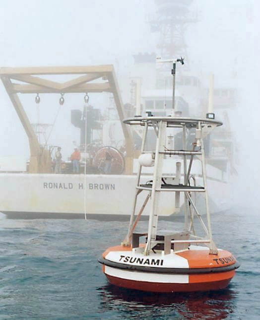
The DART (Deep-ocean Assessment and Reporting of Tsunamis) system, developed by NOAA, provides direct tsunami measurement. DART stations consist of seafloor pressure sensors connected to surface buoys. These sensors can detect the subtle pressure changes caused by a tsunami passing overhead, even in water 4,000 metres deep. The data is transmitted via satellite to warning centres within minutes.
Coastal tide gauges provide additional confirmation as waves approach shore. The network of approximately 39 DART stations, combined with hundreds of seismic stations and tide gauges, creates a comprehensive monitoring system covering the Pacific, Atlantic, Caribbean, and increasingly the Indian Ocean.
Tsunami travel times can be calculated with considerable accuracy because wave speed depends on a well-understood relationship with ocean depth. Detailed maps of ocean floor topography allow scientists to model wave propagation across entire ocean basins.
Computer models use earthquake parameters and bathymetric data to forecast wave heights, arrival times, and coastal impacts. As DART buoys detect the actual wave, these forecasts become increasingly refined. The 2011 Japan tsunami demonstrated this capability; warnings with accurate arrival times were issued for Hawaii and the U.S. West Coast hours before the waves arrived.
How Do Tsunami Warning Systems Work?
Tsunami warning systems operate through international networks coordinated by organisations including NOAA's Tsunami Warning Centres and UNESCO's Intergovernmental Oceanographic Commission. When a potentially tsunamigenic earthquake is detected, warning centres rapidly assess the threat and issue appropriate messages.
Alerts come in different levels. A tsunami "information statement" indicates an earthquake has occurred but poses no immediate threat. A "watch" means a tsunami is possible and people should stay alert. A "warning" indicates an imminent threat requiring evacuation. These messages are disseminated through emergency broadcast systems, sirens, mobile phone alerts, and direct notifications to emergency managers.
The Pacific Tsunami Warning System has operated since 1949, established after a devastating tsunami struck Hawaii in 1946. Following the 2004 disaster, similar systems were established for the Indian Ocean, Caribbean, and Mediterranean regions.
How Much Warning Time Is Usually Available Ahead of a Tsunami?
Warning time varies enormously depending on distance from the source. For distant tsunamis, warnings may arrive hours before the waves. Residents of Sendai had only eight to ten minutes of warning before the tsunami struck, and more than a hundred evacuation sites were washed away. In contrast, Hawaii had about seven hours to prepare.
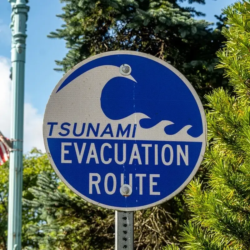
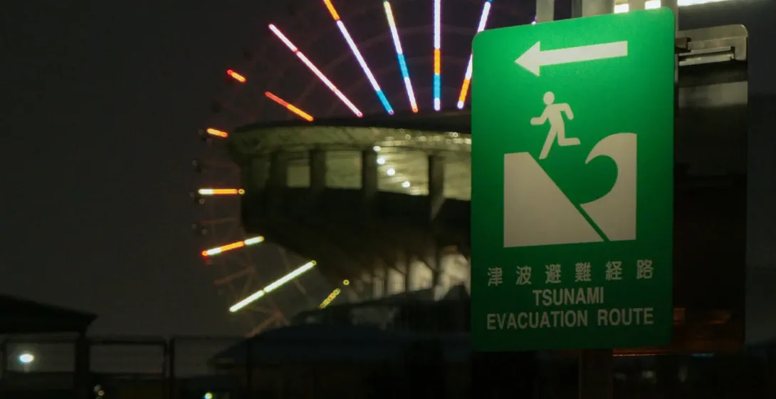
Local tsunamis present the greatest challenge. When an earthquake occurs just offshore, the first waves may arrive within 10 to 30 minutes, before any official warning can be issued. In these situations, people must recognise natural warning signs and evacuate immediately without waiting for official notification. This is why tsunami education emphasises that a strong, long earthquake near the coast is itself a warning to move to high ground.
What Role Do Education and Community Drills Play in Reducing Impacts?
Education and practice save lives. Communities that regularly conduct tsunami drills respond more effectively when real events occur. Japan's extensive tsunami education programme contributed to relatively lower casualties in areas where people knew evacuation routes and acted quickly during the 2011 event.
One powerful example: In 2004, a 10-year-old British girl named Tilly Smith recognised the signs of an approaching tsunami on a Thai beach because she had learned about them in school. Her warning helped evacuate the beach before the wave arrived, saving roughly 100 lives. This demonstrates how basic tsunami education can have life-saving consequences.
UNESCO's TsunamiReady programme recognises communities that meet specific preparedness standards, encouraging continuous improvement in readiness. Regular drills ensure evacuation routes remain familiar and identify potential problems before an actual emergency occurs.
How Do Scientists Research Past and Future Tsunamis?
Paleotsunami research examines geological evidence of past tsunamis, including distinctive sediment deposits left by waves flooding the land. These sandy layers, sometimes found kilometres from current coastlines, reveal the reach and frequency of ancient events. Research in Thailand following the 2004 tsunami found evidence of at least three similar events over the preceding 2,800 years.
Computer modelling allows scientists to simulate tsunami behaviour under various scenarios, testing how different earthquake sources would affect coastlines. These models inform hazard maps and evacuation planning. Post-event surveys of tsunami deposits help validate and improve these models.
Historical records, particularly extensive ones from Japan, provide valuable long-term perspective on tsunami frequency and severity. Combining historical accounts with geological evidence creates a more complete picture of tsunami hazards facing specific regions.
How Are Tsunamis Recorded and Classified?
The Global Historical Tsunami Database, maintained by NOAA's National Centers for Environmental Information, records information on over 1,200 confirmed tsunamis dating back to 1610 BC. Entries include source location, cause, wave heights, and impacts.
Tsunamis are sometimes classified by their intensity, using scales similar to earthquake magnitude scales. Intensity depends on factors including maximum wave height, runup (how high water reaches above sea level), and distance of inland penetration. There's no single universally used tsunami scale, though several have been proposed for different purposes.
How Do Countries Cooperate on Preparing for Tsunamis?
International tsunami cooperation operates through several networks coordinated by UNESCO's Intergovernmental Oceanographic Commission. The Pacific Tsunami Warning System, established in 1949, was the first such international effort. Following the 2004 disaster, similar systems were established for the Indian Ocean, Caribbean, and Mediterranean regions.
These systems share seismic data, DART buoy readings, and tide gauge observations in real time. When a potentially tsunamigenic earthquake occurs, information flows quickly between warning centres, enabling rapid assessment and alert distribution. Countries also share expertise on hazard mapping, evacuation planning, and public education.
Regular international exercises test the warning systems and coordination procedures. These exercises, sometimes conducted unannounced to simulate real conditions, help identify weaknesses and improve response capabilities. The goal is to ensure that no coastal community faces a tsunami without warning, as occurred in the Indian Ocean in 2004.

What Major Tsunamis Have Shaped History?
Throughout history, tsunamis have destroyed cities, shifted coastlines, and influenced civilisations. Ancient Greek historians including Thucydides wrote about tsunamis, correctly associating them with undersea earthquakes as early as 426 BC. Some researchers suggest tsunamis may have contributed to the decline of ancient coastal civilisations in the Mediterranean.
The 1755 Lisbon earthquake and tsunami killed an estimated 50,000 people and devastated one of Europe's major cities. The 1883 eruption of Krakatau generated tsunamis that killed over 36,000 people. The 1896 Sanriku tsunami in Japan killed over 27,000. The 1960 Chile earthquake generated a Pacific-wide tsunami that caused deaths and damage as far away as Japan and Hawaii.
Image: The Earthquake of 1755, painted from 1756 to 1792 by João Glama Ströberle (1708-1792). Currently in the National Museum of Ancient Art, Lisbon, Portugal.
What Happened in the 2004 Indian Ocean Tsunami?
The 2004 Indian Ocean tsunami remains the deadliest in recorded history. On 26 December 2004, a magnitude 9.1 earthquake struck off the coast of Sumatra, Indonesia. This was the third-largest earthquake recorded since 1900, releasing energy equivalent to approximately 23,000 Hiroshima-type atomic bombs. The earthquake occurred 18.6 miles (30 kilometres) below the ocean floor along a reverse fault in the Sunda Trench, where the Indian plate subducts beneath the Burma plate. The length of the rupture was roughly 1,300 kilometres.
This immense energy release allowed the resulting tsunami to radiate outward across the entire Indian Ocean basin. Waves struck the Aceh coast of Indonesia within 15 to 20 minutes, reaching heights of up to 51 metres (167 feet) in some locations and penetrating 5 kilometres inland. Thailand, Sri Lanka, India, the Maldives, and eventually the coast of East Africa all experienced significant impacts. The tsunami reached Somalia, roughly 4,500 kilometres from the epicentre, about seven hours later.
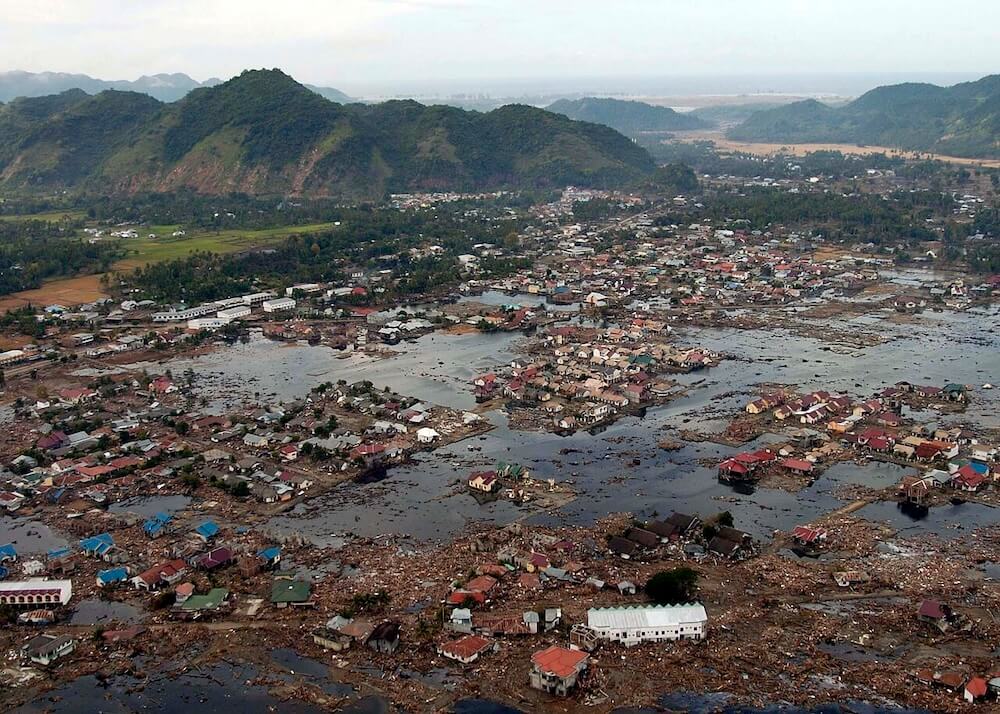
Image Source: U.S. Navy/Philip A. McDaniel, Wikimedia Commons. Public Domain.

Approximately 228,000 people died, with Indonesia, Sri Lanka, India, and Thailand suffering the highest casualties. The Andaman Islands and coastal communities throughout the Indian Ocean were devastated. About 1.7 million people were displaced. The disaster prompted establishment of the Indian Ocean Tsunami Warning System and renewed global focus on tsunami preparedness.
What Happened in the 2011 Japan Tsunami?
On 11 March 2011, a magnitude 9.1 earthquake struck off the northeast coast of Honshu, Japan. This was the largest earthquake ever recorded in Japan and the third-largest in the world since 1900. The quake occurred at a relatively shallow depth on the Japan Trench, where the Pacific Plate subducts beneath the North American Plate.
The earthquake triggered a massive tsunami that overwhelmed seawalls along Japan's northeastern coast. Waves reached heights of up to 40.5 metres in some locations and travelled up to 10 kilometres inland in flat areas. The official figures released in 2021 reported 19,759 deaths, with over 90% drowning in the tsunami rather than being killed by the earthquake itself. Over 120,000 buildings were completely destroyed.
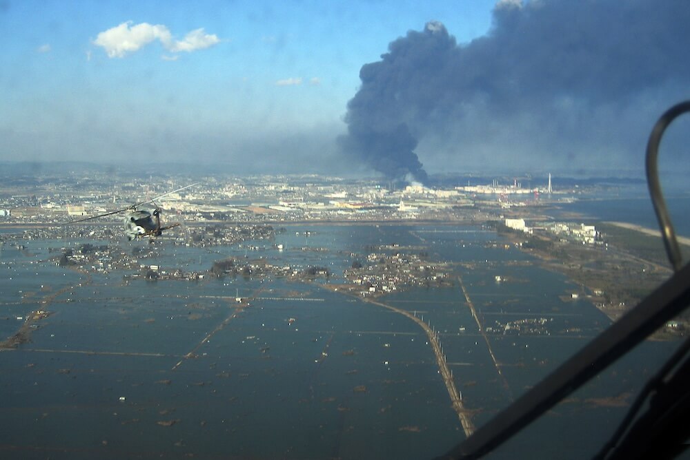
Image Source: U.S. Navy, Wikimedia Commons. Public Domain.

The tsunami disabled the Fukushima Daiichi nuclear power plant's cooling systems, triggering a nuclear meltdown. This accident was rated at the highest severity level alongside Chernobyl, forced evacuation of surrounding areas, and created long-term contamination concerns. Japan's sophisticated warning system provided alerts within minutes, but proximity to the source meant many coastal communities had only 10 to 30 minutes before waves arrived. The event led to major reviews of tsunami preparedness worldwide and reinforced the importance of vertical evacuation options where horizontal evacuation isn't possible in time.
What Is World Tsunami Awareness Day?
The United Nations designated 5 November as World Tsunami Awareness Day in December 2015. This date commemorates a Japanese story from 1854, when a farmer named Hamaguchi Goryo set fire to his rice harvest to warn villagers of an approaching tsunami, guiding them to safety on higher ground.
World Tsunami Awareness Day promotes education about tsunami risks and preparedness measures. Events include evacuation drills, educational programmes, and community engagement activities. The day encourages people to learn evacuation routes, recognise natural warning signs, and understand how to respond to official alerts.
The United Nations Office for Disaster Risk Reduction coordinates global observance, working with national governments and local communities to improve tsunami resilience. The "#GetToHighGround" campaign encourages people to practice tsunami evacuation routes, building the muscle memory that could save lives during an actual emergency.
Tsunamis FAQs
The word "tsunami" wasn't widely used in English until the 1960s. Before then, most English speakers called these events "tidal waves," even though scientists had long understood they had nothing to do with tides.
Tsunamis can cause rivers to temporarily reverse direction. During the 2011 Japan tsunami, the Natori River was pushed backwards for several kilometres by the incoming wave.
The 2004 Indian Ocean earthquake was so powerful it caused the entire planet to vibrate by at least one centimetre. The earthquake also slightly shortened Earth's day by 2.68 microseconds.
Coral dating and sediment analysis suggest major tsunamis have struck the same coastlines repeatedly over thousands of years, though with intervals of centuries between events, long enough for communities to lose memory of the previous disaster.
Norway's fjords experienced strange wave activity during the 2011 Japan earthquake, with water appearing to "boil" and waves rolling onto shores. Scientists later determined these were seiche waves triggered by the earthquake's energy travelling through the Earth.
During the 2011 Japan tsunami, several fishing boats were swept out to sea and later found off the coast of Canada, over 6,600 kilometres away. Some were still floating after crossing the Pacific Ocean, while others washed ashore on British Columbia's coast.
Some coastal communities have "tsunami stones," centuries-old markers warning future generations not to build below a certain elevation. Many of these ancient warnings proved accurate during the 2011 Japan tsunami, with destruction occurring primarily below the marked lines.

Dive Deeper: NOC's Tsunami Research
The NOC's efforts in sensor deployment, combined with geological studies, seismic studies, and fibre-sensing technologies, are transforming how we observe and understand tsunamis. Ultimately, this work helps us prepare for these events and protect vulnerable coastal communities worldwide.