When people think of tsunamis, they often picture destructive waves reaching the shore. But the story often begins deep beneath the ocean surface.
This World Tsunami Awareness Day, National Oceanography Centre (NOC) scientists are highlighting the vital research helping improve understanding of how tsunamis are generated, and how better forecasting and preparedness can reduce their impacts. This work involves close collaboration with partners including Tonga Geological Services, helping inform risk assessments for communities exposed to tsunami hazards.
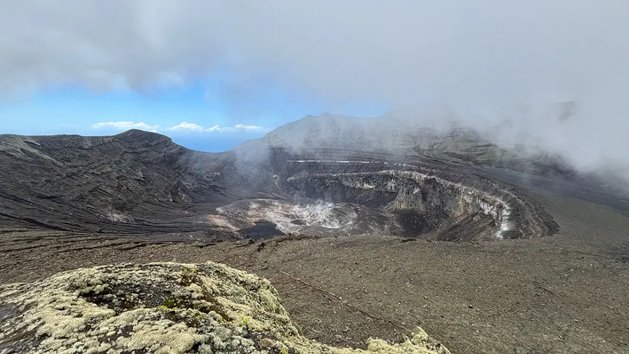
At NOC, researchers including Dr Isobel Yeo, Dr Michael Clare and Dr James Hunt investigate the complex chain of events that can trigger tsunamis, including submarine volcanic explosions and caldera collapses using the 2022 Hunga Volcano eruption (offshore Tonga) as a natural laboratory.
2022 Hunga Volcano
Cutting-edge seafloor mapping, geophysical monitoring, and land-based surveys in areas affected by tsunamis, are all helping to uncover the processes that create these hazards and how they interact. While most tsunamis are triggered by earthquakes, some of the deadly events have occurred as a result of underwater volcanic eruptions, yet these phenomena remain largely unmonitored and poorly understood. This means that many coastal communities remain unprepared for such events.
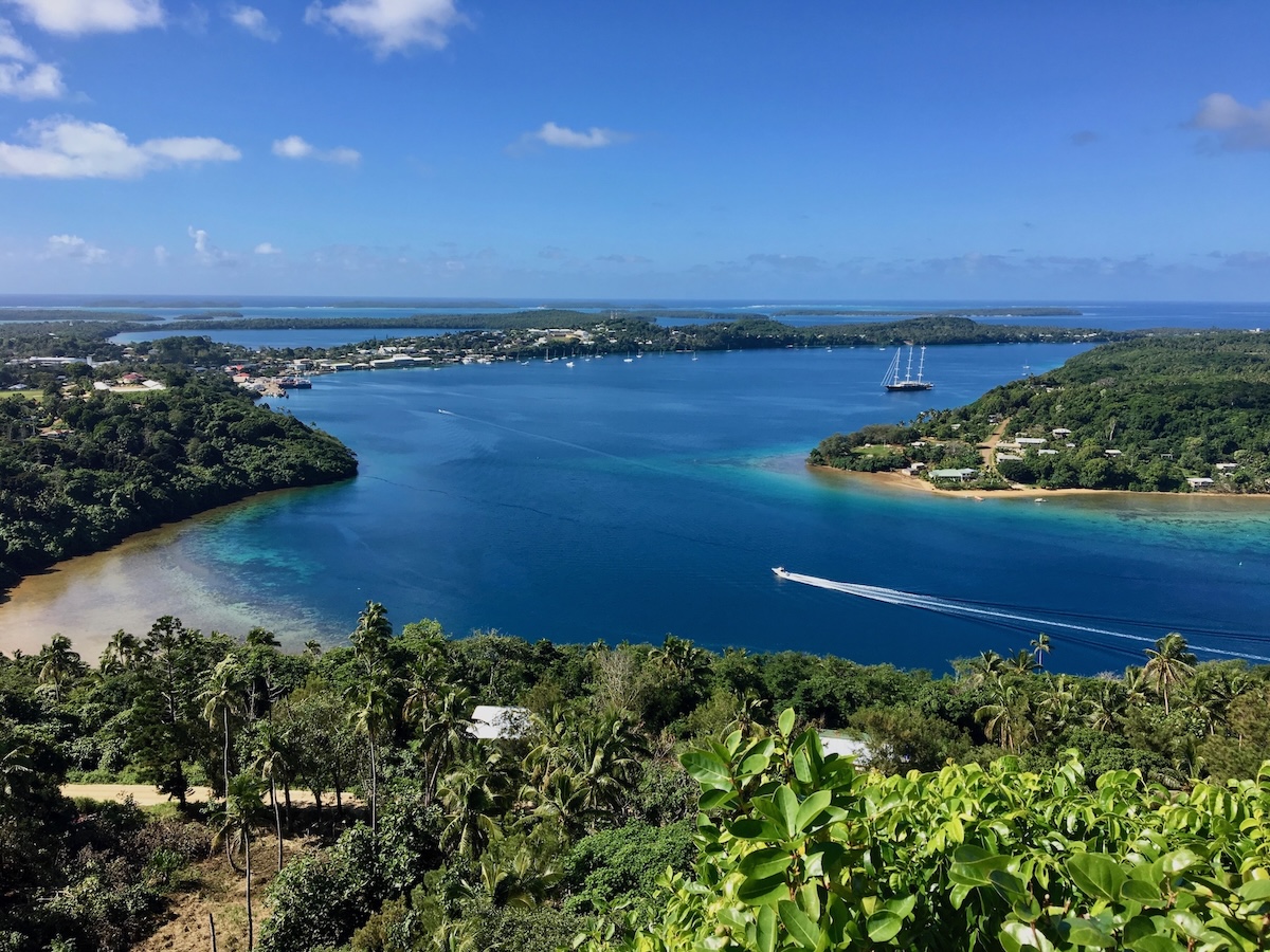
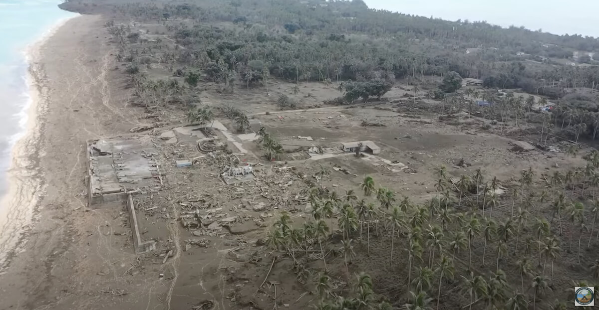
The Hunga volcanic eruption was the most explosive volcanic eruption this century and provided a unique window to learn about volcanic tsunami. The 2022 eruption generated tsunamis that took lives on the other side of the Pacific Ocean, with local runup heights locally exceeding 25 metres that caused widespread damage to coastal infrastructure. Through a range of collaborative projects, NOC researchers have:
- Reconstructed tsunami-generating events using distant monitoring stations. Underwater sound signals recorded by seismic stations more than 2,000 km away helped identify the timing of caldera subsidence linked to Hunga’s largest local tsunami.
- Investigated multiple ways volcanic eruptions can generate tsunamis. These include water displaced by caldera collapse, powerful flows of hot volcanic material entering the ocean, and pressure waves produced by explosive eruptions.
- Explored connected hazards above and below the waves. Research has revealed how eruptive activity generates destructive underwater flows that reshape the seafloor and damage critical infrastructure, including telecommunications cables.
- Investigated how sediments record past events. Studies of coastal tsunami deposits and offshore volcanic deposits help scientists assess what the geological record can reveal about previous events and their impacts.
- Worked with South Pacific partners to identify vulnerabilities in island communities and critical infrastructure, and support improved hazard assessment, preparedness and resilience.
Could a Tsunami Affect the UK?
While much research focuses on internationally significant events, such as the tsunami generated by the 2022 Hunga Volcano eruption and the tsunami associated with the eruption and flank collapse of Anak Krakatau Volcano in Indonesia, scientists at NOC are also seeking to better understand tsunami risk in the United Kingdom.
At first glance, it may seem unlikely that tsunami represent a significant natural hazard to the UK.
Unlike regions around the Pacific Ring of Fire, the UK is not situated within an area of active plate tectonics or volcanism. As such, two important questions arise: do tsunami pose a significant hazard to the UK, and, if so, to what extent are our coastlines, infrastructure, and communities exposed to that hazard?
Evidence for the tsunami hazard faced by the UK can be found in our own geological history.
Around 8,200 years ago, a huge submarine landslide, known as the Storegga Slide, occurred off the coast of Norway. More than 3,000 km³ of sediment collapsed downslope, generating a tsunami that swept across the North Atlantic. Waves up to 15-20 m high reached parts of Scotland, while coastlines around the North Sea, including the now-submerged landscape of Doggerland, were also inundated.
Although such events are rare, geological records from the Norwegian continental margin show that the Storegga Slide was not unique, demonstrating that tsunami-generating submarine landslides have occurred repeatedly over geological timescales. While a Storegga-scale event is extremely unlikely on human timescales, other tsunami sources, including submarine landslides around the North Atlantic margin, volcanic island collapses, and distant earthquakes, continue to contribute to contemporary tsunami hazard assessments for UK coastlines.
Potential tsunami sources affecting the United Kingdom extend well beyond the Norwegian continental margin. Large submarine landslides occurring offshore Greenland, eastern North America, Iberia and northwest Africa possess the capacity to generate far-field tsunami that could impact UK coastlines. In parallel, extensive submarine landslide deposits identified around volcanic ocean islands, particularly the Canary Islands, have raised concerns regarding the tsunami potential of catastrophic flank-collapse events. Finally, although the Atlantic lacks the extensive subduction systems that characterise the Pacific Ocean, tectonically active plate boundaries remain capable of generating transoceanic tsunami.
Collectively, these sources demonstrate that, despite its location away from major tectonic and volcanic centres, the UK remains exposed to a diverse range of potential tsunami-generating processes.
Quantifying this exposure requires an understanding not only of the frequency and magnitude of potential tsunami sources, but also of how waves propagate across the North Atlantic and interact with the complex bathymetry and coastal morphology of the UK continental shelf. Such assessments increasingly rely on numerical modelling, high-resolution seafloor mapping and coastal inundation simulations to identify regions of heightened vulnerability and inform risk mitigation strategies.
So Where Are We?
The United Kingdom is actively engaged in international tsunami preparedness efforts through its participation in the Intergovernmental Oceanographic Commission (IOC) of UNESCO Tsunami Programme, including the development of National Tsunami Warning Centres and the North-eastern Atlantic, Mediterranean and Connected Seas Tsunami Warning and Mitigation System (NEAMTWS). Through these collaborations, the UK is not only improving its resilience to tsunami hazards but is also contributing to the objectives of the United Nations Decade of Ocean Science for Sustainable Development and the Sendai Framework for Disaster Risk Reduction.
Preparedness takes many forms, from advances in scientific understanding and monitoring capability to improvements in emergency planning and public awareness.
Coinciding with World Tsunami Awareness Day, the recent conclusion of the NEAMWave 26 exercise programme has provided an important opportunity to test these capabilities. This year's exercises simulated a series of hypothetical tsunami events distributed across the Atlantic Ocean and Mediterranean Sea, enabling participating nations to evaluate the effectiveness of warning dissemination procedures, communication networks and emergency response protocols.
These exercises demonstrate that effective tsunami preparedness depends not only on robust monitoring and warning systems, but also on well-trained emergency management personnel and clear pathways for translating scientific information into timely action. While destructive tsunami events remain infrequent around the UK, maintaining readiness through international cooperation, scientific research and regular exercises remains essential for reducing future risk.
By improving our understanding of these powerful natural hazards, scientists can help communities around the world become better prepared for future events.
Recent Research
Be part of the community helping our ocean thrive.



Related Resources
Our Discover the Ocean pages are built to answer some of the biggest questions facing the ocean, and shine a light on the vital role it plays in keeping the planet healthy.
In the News
To explore some of the latest marine science discoveries and breakthroughs, head over to our latest news page.