
An international team is collecting observations to understand how a melting Greenland is affecting ocean currents, which could cause weather change in UK and Europe
An international team of researchers are heading to Greenland this week (16 July 2026) for a six-week expedition to study how quickly the ice sheet’s rapidly melting fjord glaciers are pushing the Atlantic Ocean towards a critical climate tipping point.
The team will travel on the UK’s polar research ship RRS Sir David Attenborough, and use a range of sophisticated equipment, such as a fleet of airborne drones, marine robots, satellites and sensors to study the glaciers and surrounding ocean. The data collected will be used to improve our predictions for the future of Greenland’s glaciers and their impact on the surrounding ocean as they melt.
Their fieldwork is part of a five-year project called GIANT (Greenland Ice sheet to AtlaNtic Tipping points), a large international collaboration of 17 partners (including seven international partners) led by British Antarctic Survey (BAS) and funded by the Advanced Research + Invention Agency (ARIA), as part of their Forecasting Tipping Points programme.
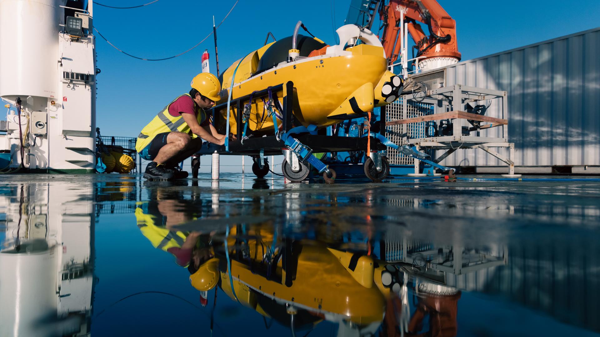
We've operated Autosub Long Range beneath glaciers before, but this will be the first time we've attempted to simultaneously map both the underside of the ice and the seafloor beneath it. To achieve that, we're carrying an unusually high-power mapping payload that will deliver richer, higher-resolution data, allowing us to capture a more complete picture of the hidden cavity where ocean and ice interact.
Dr Alex Phillips, Head of Marine Autonomous Robotic Systems at NOC
The planet’s ocean conveyor belt
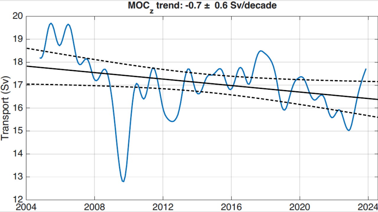
Greenland’s rapidly melting ice is adding vast quantities of freshwater into the ocean. Scientists are concerned this could affect a major Atlantic Ocean current system – the North Atlantic Subpolar Gyre. This ‘whirlpool’ of ocean currents affects the Atlantic Meridional Overturning Circulation (AMOC) – the planet’s ocean conveyor belt that moves heat and nutrients around the world and keeps our planet stable.
The AMOC brings warm, salty water from the tropics to the north. This is cooled by the cold, sub-Arctic air, and sinks. This sinking ocean pulls more water up from the south, driving the 3-dimensional conveyor belt of water. However, fresh, cold meltwater from Greenland’s melting fjord glaciers could put a ‘cap’ on the Subpolar Gyre and reduce the water beneath it from sinking. If this happens, the AMOC could slow, with serious implications for the regional climate, including the UK. Some estimates suggest this change could happen within decades.
We’re in a moment where our tools have finally caught up with our questions. With autonomous vehicles, advanced sensors, and powerful modelling – boosted by AI – we can explore glacier-ocean interactions in ways that were unimaginable just a few years ago.
Dr Kelly Hogan, a marine geophysicist at British Antarctic Survey is leading the GIANT research project.
The RRS Sir David Attenborough will transport researchers from the UK to south-east Greenland, where they will study tidewater glaciers near Kangerlussuaq Fjord. These glaciers flow through long, narrow fjords and end in towering ice cliffs, up to 100m tall. Frequent iceberg calving creates an ice mélange; a dense, slushy pack of sea ice and chunks of icebergs that can act as a brake on the glacier and slow its flow into the ocean. When this debris clears in the summer, calving rates increase and glaciers can retreat rapidly.
Scientists will use this floating laboratory to conduct detailed measurements of fjord depth and shape, as well as ocean temperature, salinity and currents, as well as being a launch platform for a range of autonomous vehicles that will sample in the hazardous region near the ice.
Using these instruments, researchers will study fjord and glacier behaviour on different scales, looking at individual cracks in the ice to the flow of meltwater and icebergs into the North Atlantic.
A fleet of science robots
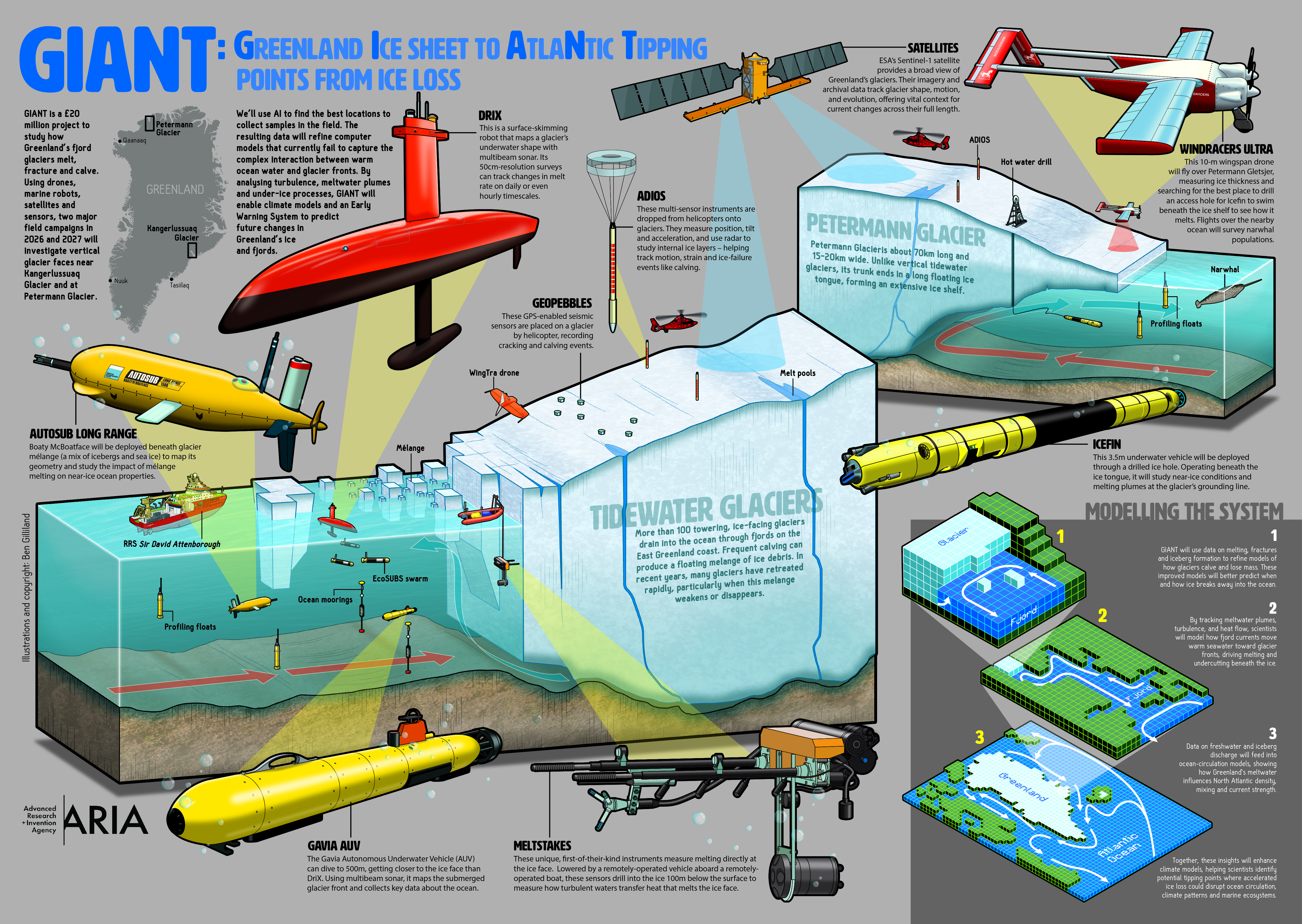
Among the many advanced tools being deployed as part of this mission is Meltstake. This first-of-its-kind instrument measures melting directly at the ice face. Lowered by a remotely operated boat, this sensor will drill into the ice 100m below the surface to measure how water transfers heat to the ice.
DriX – a surface skimming robot – will map the shape of the glacier under the water with a scanning sonar. It will track changes in melt rate on daily or even hourly timescales. It will also collect information about ocean properties close to the glacier.
A family of robots – Gavia and EcoSubs that swim in coordination with each other using acoustic positioning technology – will dive hundreds of metres below the surface as a team, collecting data from the glacial ice face. They can go closer to the ice face than DriX, mapping the submerged glacier front, and collecting data about the ocean.
The UK’s most famous underwater robot – Boaty McBoatface – will also be part of the fleet. The Autosub Long Range-1 (ALR-1), developed by the National Oceanography Centre (NOC), will dive 1500m deep below the mélange, a chaotic aggregate of icebergs that choke some of the fjords, to map its geometry, and study how it impacts the surrounding ice and ocean as it melts.
If we want to understand how glaciers melt and fracture, we need to be where the action happens – where the glacial ice meets the ocean. We need these ocean robots to do this – the glacier front is so unpredictable and dangerous, because huge blocks of ice calve into the ocean with little warning.
With the fleet of autonomous and remotely controlled instruments we have with us, some of the data we’ll be collecting will be the first of its kind. The DriX will give us a near-live feed of what is happening right at the glacier face – something we wouldn’t have thought possible even a few years ago.
Dr Pierre Dutrieux is an oceanographer at British Antarctic Survey and is leading the ocean robotics research on RRS Sir David Attenborough.
Camping on the ice
A small team of researchers will also be camping near the glacier itself, to collect even more data about how the ice is behaving. An instrument called Adios will be installed on the glacier to measure the precise position of the glacier and how fast it’s moving. It uses radar to study internal ice layers, helping track how the ice is moving and straining. They’ll also deploy small instruments called Geopebbles – GPS-enabled seismic sensors which record cracking and calving events.
From data to decisions
This array of data collection is so vital because current climate models don’t accurately represent the complex ways in which Greenland’s glaciers interact with the warming ocean. Boosted by machine learning and AI, the data collected this summer will feed directly into a hierarchy of ice, ocean and climate models. This includes the next-generation UK Earth System Model, which – because of GIANT – will be better equipped to predict how Greenland ice loss impacts global climate change.
The researchers also plan to develop a prototype Early Warning System to provide advance notice of rapid glacier change.
About GIANT
For more information about GIANT, including a full list of all scientific instruments used in the project, please visit the dedicated website (with translation in Danish and Greenlandic): https://giantgreenland.com/
GIANT is one of 25 projects funded by the ARIA as part of its £81 million Forecasting Tipping Points programme. By combining innovative sensing systems, ambitious field campaigns, and advances in physics-based and AI-driven models, the ARIA programme aims to develop a proof-of-concept early warning system for climate tipping points – equipping global leaders and society with the vital information needed to build resilience and accelerate proactive climate adaptation.
The partners:
The GIANT project is funded by ARIA and is a partnership between the following organisations:
- British Antarctic Survey (BAS)
- The Alan Turing Institute
- Cambridge University
- Cardiff University
- Cornell University
- Danish Meteorological Institute
- Exeter University
- Greenland Institute of Natural Resources
- University of Edinburgh
- University of Leeds
- National Oceanography Centre
- Oregon State University
- University of Reading
- Scottish Association for Marine Science
- University of St Andrews
- University of Stirling
- Technical University of Denmark
- University of the Faroe Islands
About ARIA
Created by an Act of Parliament, and sponsored by the Department for Science, Innovation, and Technology, ARIA funds breakthrough R&D in underexplored areas to catalyse new paths to prosperity for the UK and the world. We empower scientists and engineers to pursue research that is too speculative, too hard, or too interdisciplinary to pursue elsewhere. www.aria.uk
Be part of the community helping our ocean thrive.